

Mount Saint Helens is a volcano in the Cascade Range in southern Washington which has always fascinated me since I was a young boy, being that I was 5 1/2 years old when it erupted on May 18, 1980. Thus I was finally able to fulfill a lifelong dream in a sense when we had the opportunity to hike to the summit of Mount St. Helens in September of 2010. Being that the hike took place through a landscape which had been deeply affected and shaped by the volcanic eruption of thirty years ago, the journey turned out to be like nothing I had ever experienced before. Basically, the hike (or climb) has three very unique parts to it. The first part takes you through a beautiful section of the Gifford Pinchot National Forest with towering trees, wildlife (we saw a family of deer on the trail), and nice views during the latter half of this two mile section. The second part involves climbing and navigating safely through volcanic mountain and lava boulders, many of which are huge in size. There are trails which are both easy and hard to follow at times during this section, but basically you are climbing from wooden post to wooden post. The third and final part is trudging steeply uphill through volcanic ash which is covering the ground and hard to make progress on. Hiking on ash is harder than hiking through sand, as the going is very slow. But we followed the advice from others and brought gloves for the second part (lava boulder fields) and a trekking pole for the third part (volcanic ash) and that proved to be helpful.
It was an incredible moment to reach the crater overlook point of Mount St. Helens for the first time and look down inside the cauldron which had brought forth so much destruction and death thirty years earlier. We could also see Washington state's newest glacier, which has begun forming around the Lava Dome inside the crater. Beyond the volcano we were standing on, we could see three more Cascade volcanoes far off in the distance. These included Mount Hood in Oregon (60 miles southeast), Mount Adams (34 miles east), and Mount Rainier (50 miles north). It was also amazing to think that the peak we were standing on at the summit of Mount St. Helens was located at 8,365 feet in elevation. But prior to its eruption, the volcano had stood over 1,300 feet higher at 9,677 feet in elevation. The hike itself was also very memorable because of the weather and conditions we experienced. On our hike up, Daria and I could see absolutely nothing. It was raining and cloudy outside, and we met hikers who were turning around and giving up, thinking that the hike was not worth it as visibility was near zero. Yet, we persevered and got an amazing surprise only about 100 feet in elevation below the summit. All of a sudden, we broke through the clouds and ended up above them, giving us perfect views in every direction of the other Cascade volcanoes, as well as into the crater of Mount St. Helens. Then, on the hike down, all of the clouds broke away and we could see how eerily beautiful the area was which we had just hiked through. It was definitely an amazing day that we will never forget. The hike/climb to the summit of Mount Saint Helens starts at Climbers Bivouac and follows Monitor Ridge to the summit for 5 miles while gaining 4,500 feet in elevation. From mid-May through the end of October, only 100 people per day are allowed to climb Mount Saint Helens, requiring a $22 permit which needs to be reserved long in advance. And all climbers considering this journey need to keep in mind that "Mount St. Helens is an active volcano. Climbers may be exposing themselves to volcanic hazards that may occur without warning."
It was an incredible moment to reach the crater overlook point of Mount St. Helens for the first time and look down inside the cauldron which had brought forth so much destruction and death thirty years earlier. We could also see Washington state's newest glacier, which has begun forming around the Lava Dome inside the crater. Beyond the volcano we were standing on, we could see three more Cascade volcanoes far off in the distance. These included Mount Hood in Oregon (60 miles southeast), Mount Adams (34 miles east), and Mount Rainier (50 miles north). It was also amazing to think that the peak we were standing on at the summit of Mount St. Helens was located at 8,365 feet in elevation. But prior to its eruption, the volcano had stood over 1,300 feet higher at 9,677 feet in elevation. The hike itself was also very memorable because of the weather and conditions we experienced. On our hike up, Daria and I could see absolutely nothing. It was raining and cloudy outside, and we met hikers who were turning around and giving up, thinking that the hike was not worth it as visibility was near zero. Yet, we persevered and got an amazing surprise only about 100 feet in elevation below the summit. All of a sudden, we broke through the clouds and ended up above them, giving us perfect views in every direction of the other Cascade volcanoes, as well as into the crater of Mount St. Helens. Then, on the hike down, all of the clouds broke away and we could see how eerily beautiful the area was which we had just hiked through. It was definitely an amazing day that we will never forget. The hike/climb to the summit of Mount Saint Helens starts at Climbers Bivouac and follows Monitor Ridge to the summit for 5 miles while gaining 4,500 feet in elevation. From mid-May through the end of October, only 100 people per day are allowed to climb Mount Saint Helens, requiring a $22 permit which needs to be reserved long in advance. And all climbers considering this journey need to keep in mind that "Mount St. Helens is an active volcano. Climbers may be exposing themselves to volcanic hazards that may occur without warning."
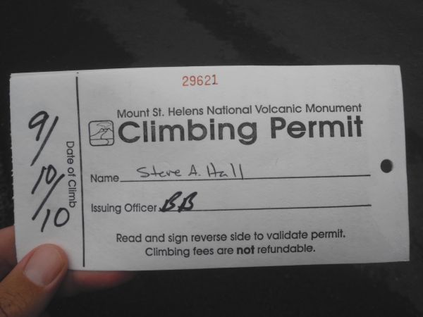
We picked up our climbing permit from the Lone Fir Resort in Cougar, Washington on the morning of our climb. The staff there was very helpful in making sure we were ready for the climb:
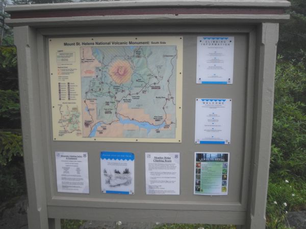
The Monitor Ridge route to the summit of Mount St. Helens begins at Climbers Bivouac, a permit only campground at the end of Forest Road 830. This is the sign and information board at the trailhead:
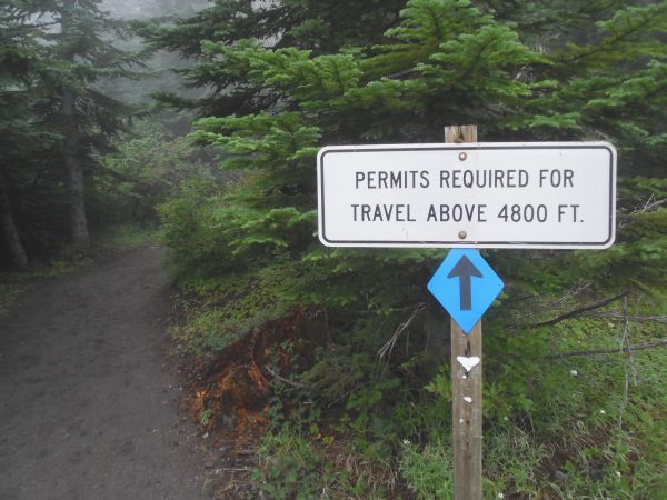
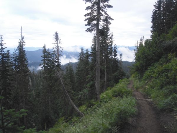
Anybody can hike the trail through the forest up to the 4,800 foot level, which is about 2/5 of the hike:
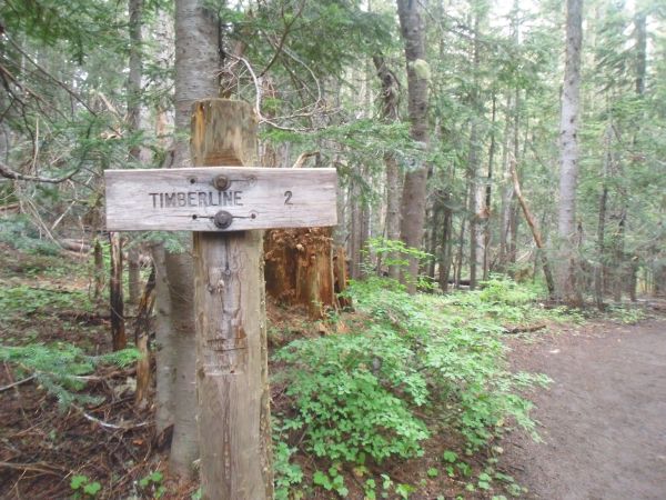
A sign notifies hikers that the hike through the forest to reach timberline will be 2 miles long:
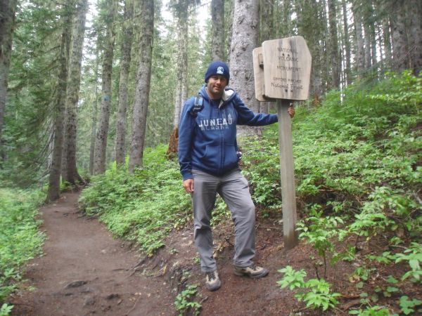
Steve next to the sign that welcomes visitors to the National Volcanic Monument:
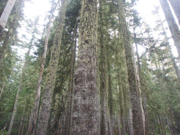
Very tall trees in the forest with moss growing on the bark:
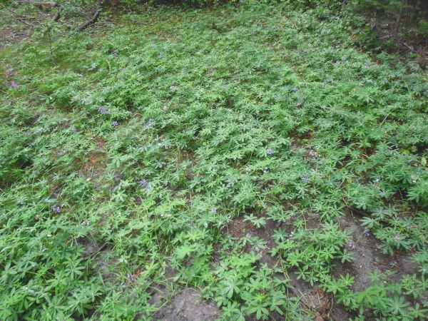
Green ground cover in the forest with purple flowers:
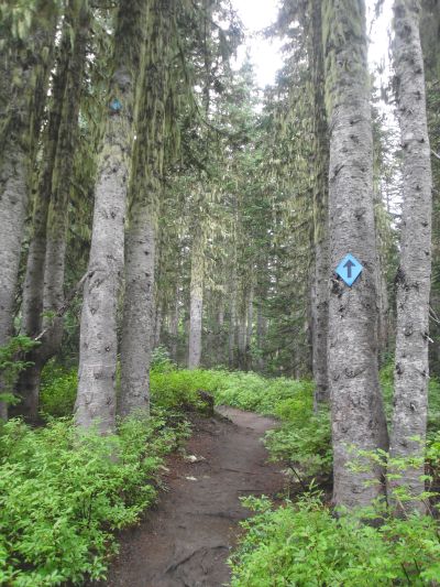
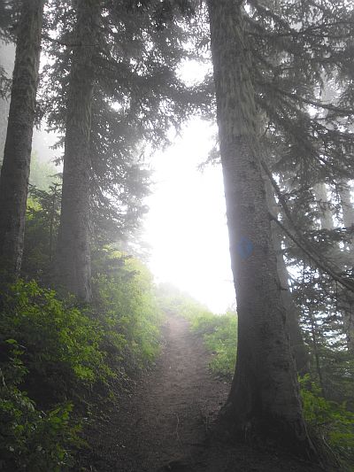
Markers direct you on the trail through the forest:
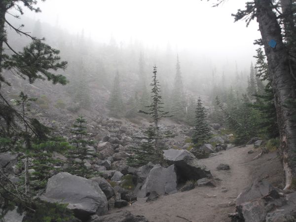
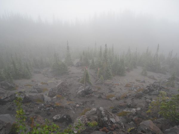
Coming out of the forest for our first view of the terrain that was to come:
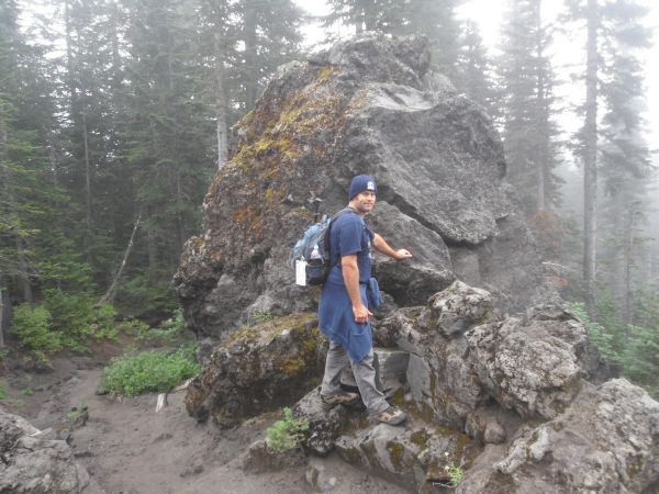
Steve pausing for a break by a massive boulder at the edge of the forest:
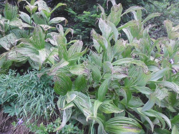
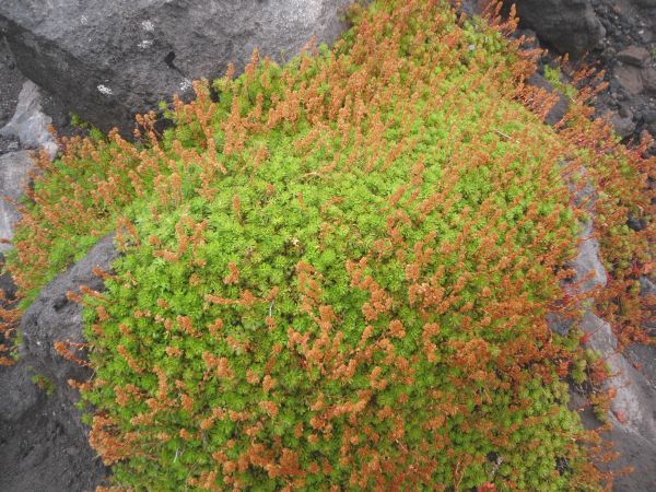
Two pictures of plants growing during this portion of the hike:
The trail then turns and winds back into the forest as it climbs a steep hill with switchbacks:
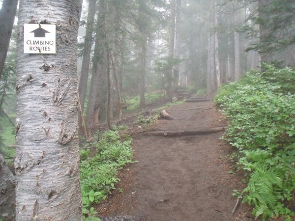
Soon we arrived at a junction in the trail. We followed the signs towards the climbing routes:
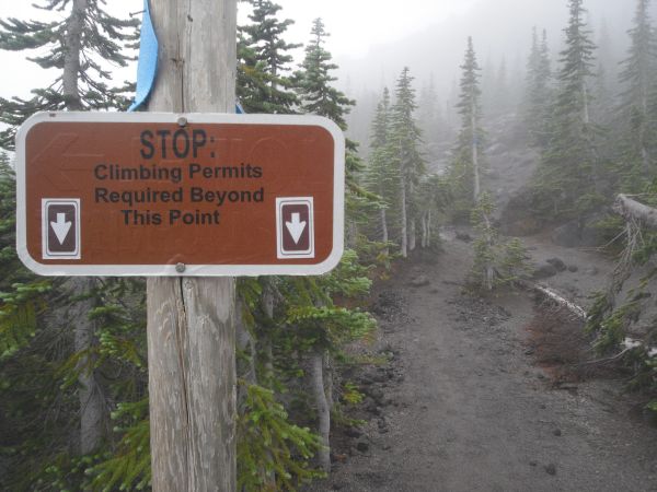
After gaining about 1,000 feet of elevation over the course of the first two miles, we reached the point where non-permit holders must stop:

In the next two pictures, we have begun to climb out of the forest and into the boulder climbing section:

Looking back down on the edge of the forest and low visibility conditions:
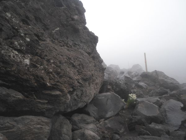
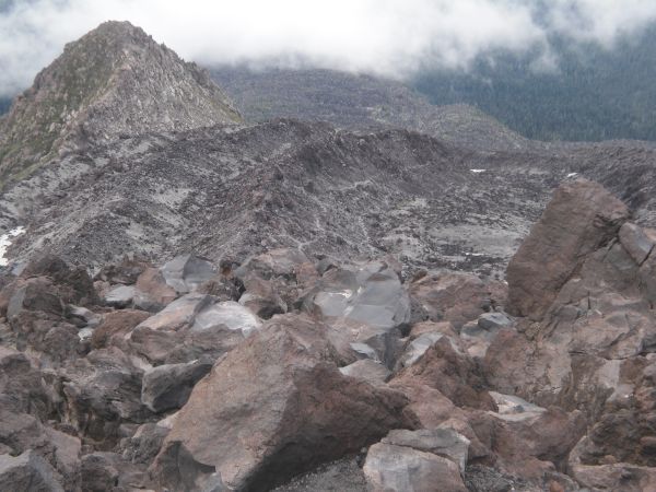
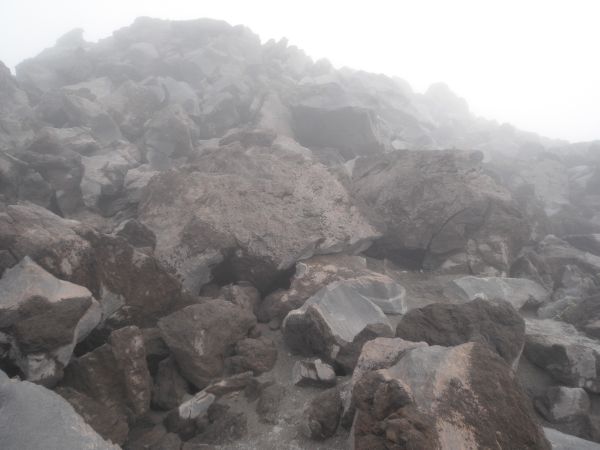
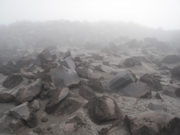
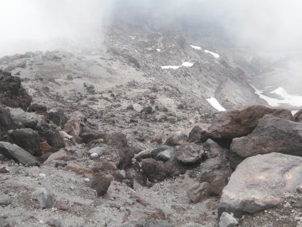
Passing by an absolutely huge boulder on the mountain. The boulders were made up of lava rocks and also rocks which had been blasted out of the mountain during the eruption:
Climbing through these boulders while gaining elevation was very slow going:
Looking down on the forest one last time before leaving trees behind:
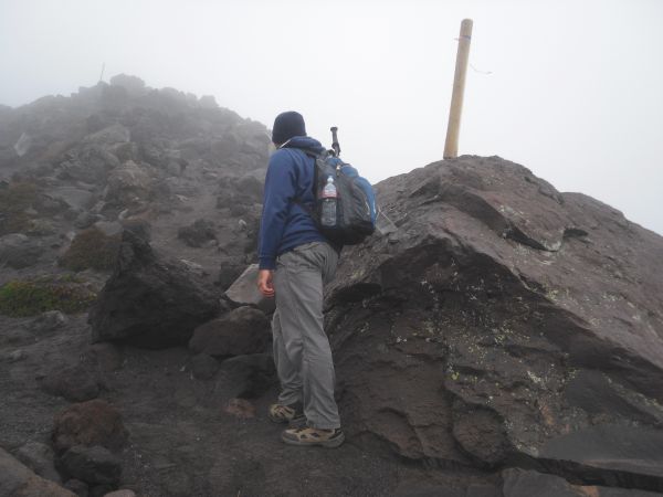
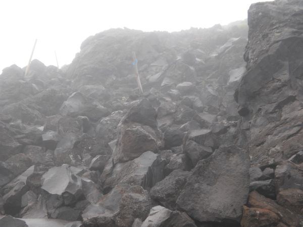
Steve looking up into the intimidating boulder climbing section. At this point, we were climbing from wood post to wood post. The wood posts have been installed by the park service to show you the correct route:
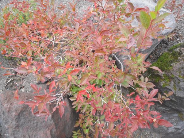
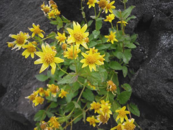
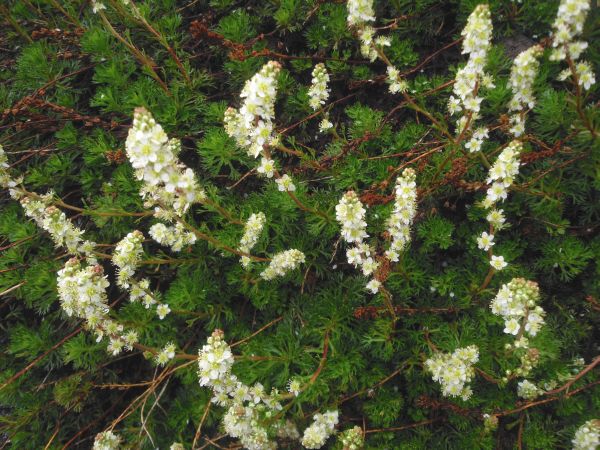
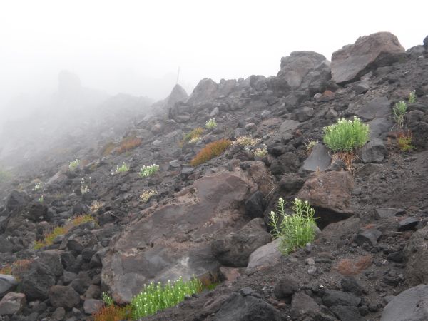
Slowly recovering from the volcanic eruption, flowers and plants are bringing life to this barren area as seen in the next six pictures:

This definitely felt like we were hiking on another planet or through an eerie landscape from a horror movie:
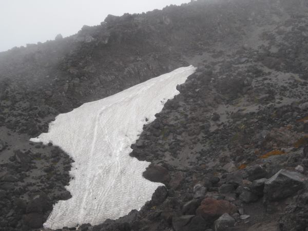
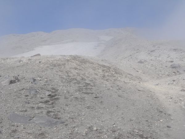
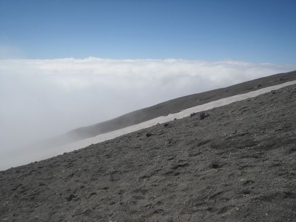
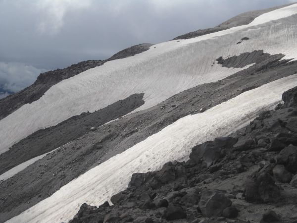
We began passing by what are probably permanent patches of snow:
Sometimes there would be a brief break from the difficult climbing on a clear trail:
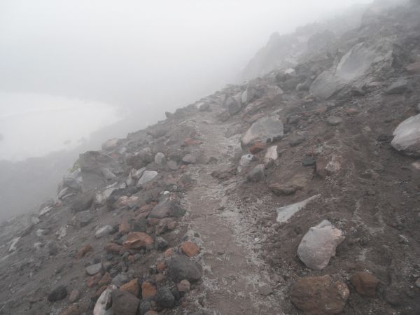
Volcanic ash began covering the ground extensively:
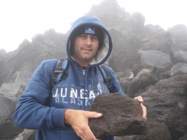
Steve showing off one of the lava rocks in abundance along the trail:
In the next two pictures, visualize having to climb to the highest point you can see, and that will give you an idea of what our journey was like:
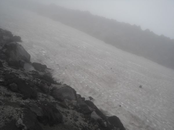
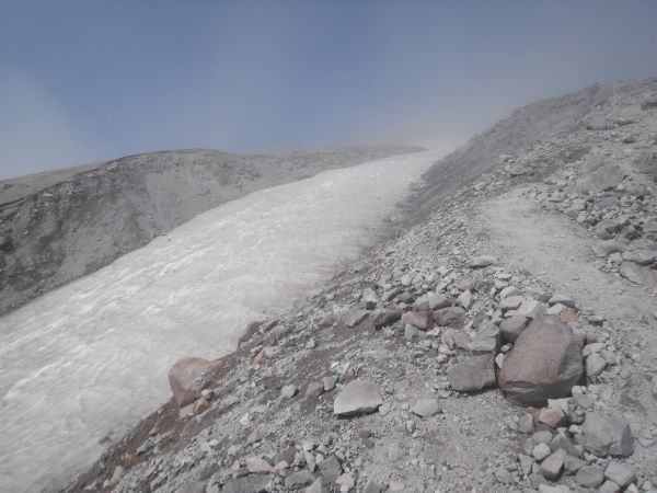
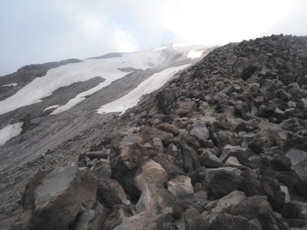
Looking across at a huge permanent snowfield along the route. We were told that some people use these for glissading on the way back down, but we avoided that risky endeavor:
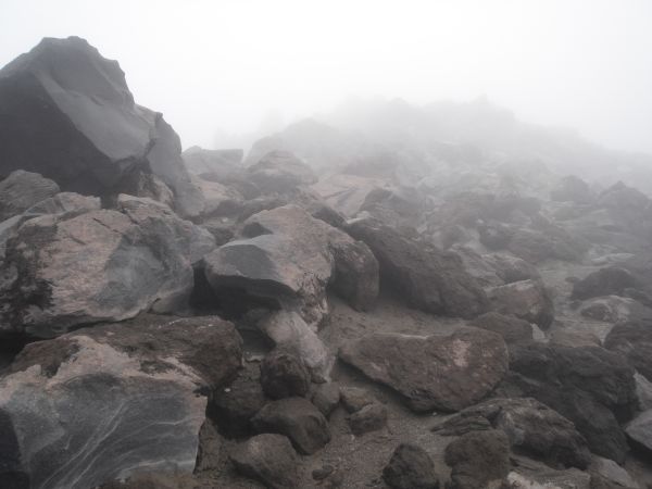
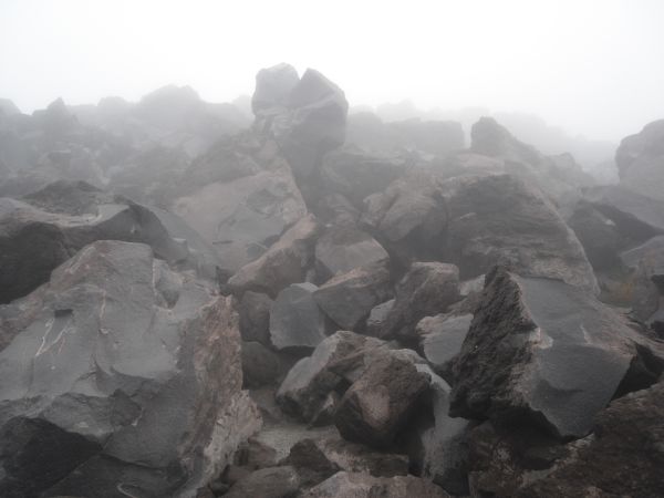
Continuing to climb the endless fields of boulders up the mountain:
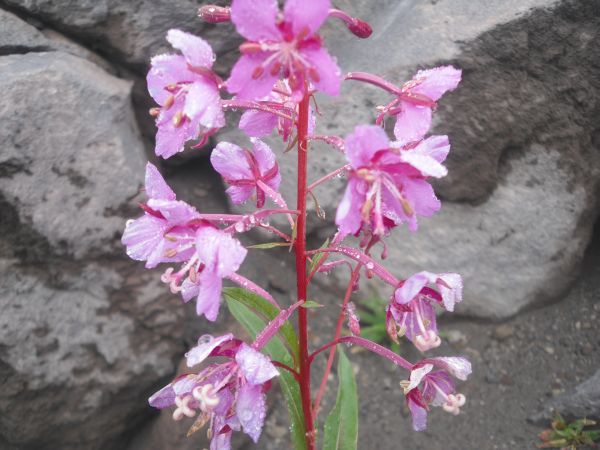
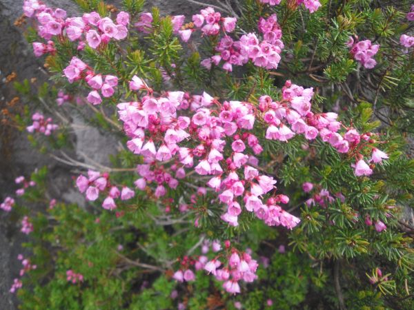
Once again life emerges from the desolate landscape in the form of a stem of beautiful pink flowers:
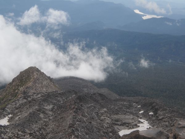
Visibility continued to be lousy during the bouldering section. We often wondered if it was worthwhile to hike all the way to the top if we couldn't see anything up there:
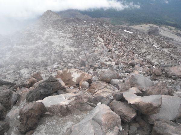
Looking up at another towering mountain of boulders we had to climb:
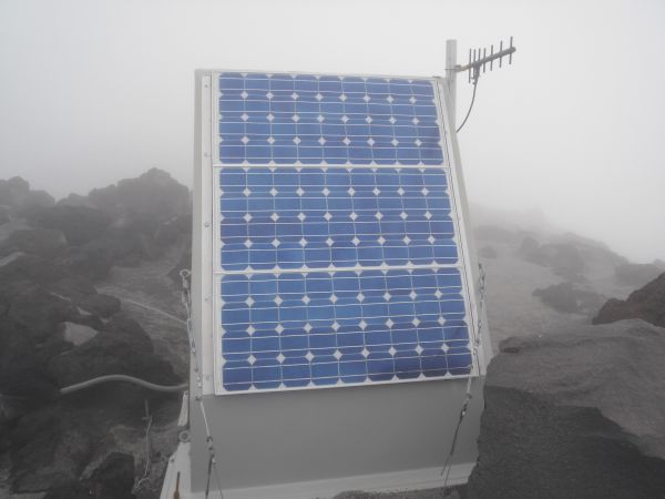
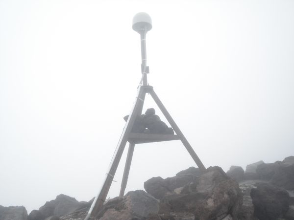
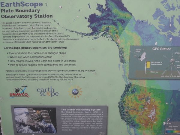
The next three pictures show a scientific research station that we passed which was monitoring movements in the earth's crust. I was wondering if this was why they called this route Monitor Ridge:
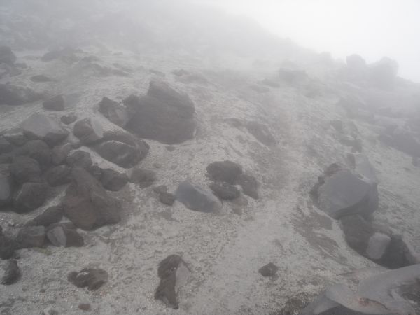
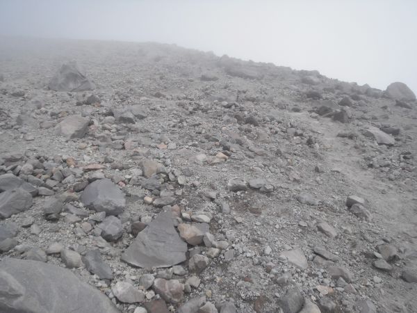
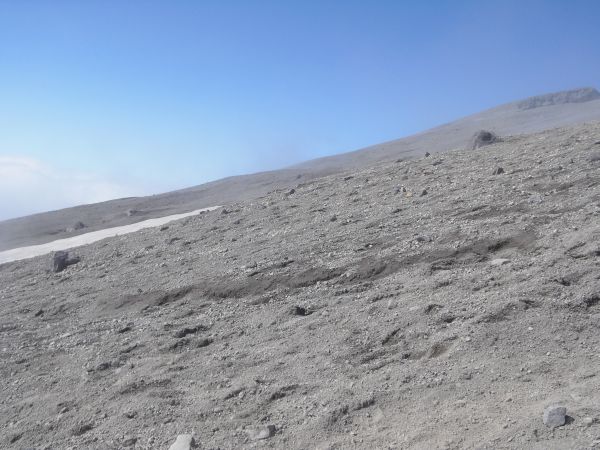
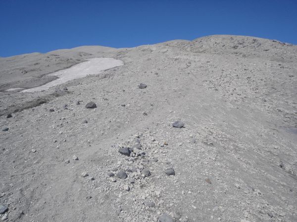
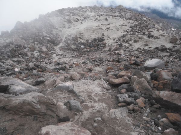
Notice how thick the ash had gotten on the ground as we progressed:
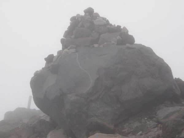
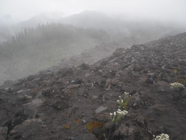
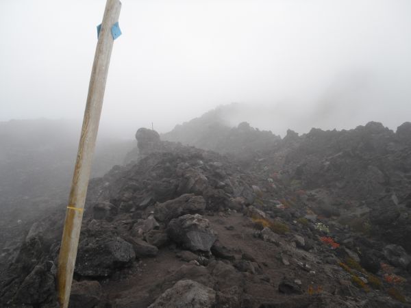
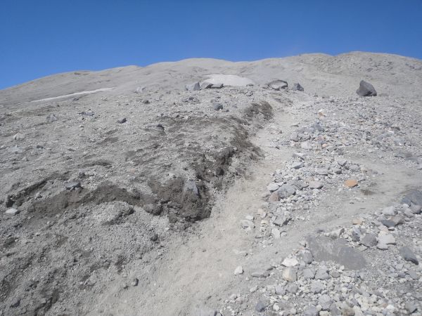
This giant boulder holding lots of rock cairns marks the end of the bouldering section and the beginning of the volcanic ash section:
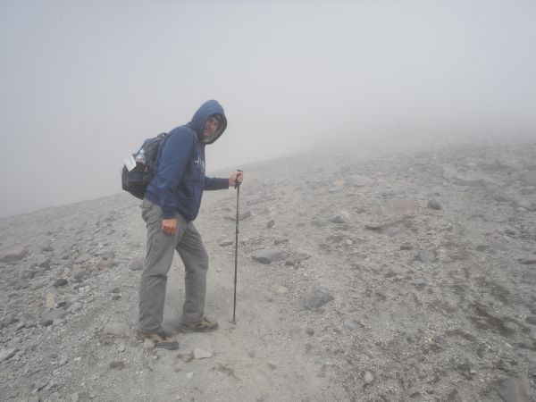
Steve heading into the haze at the start of the volcanic ash section. This was the first time as an adult that I hiked with a trekking pole. I always said they were for older people, but on this hike the poles were helpful:
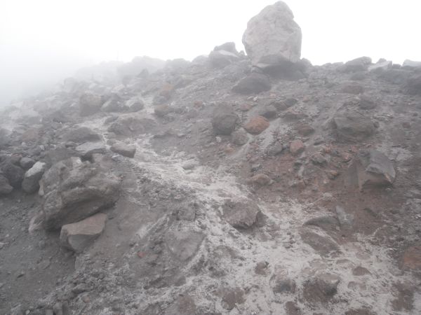
The ground was mostly soft volcanic ash, but there were parts with small rocks:
As we neared the top, the clouds suddenly started to clear and we could see blue sky ahead for the first time in the day:
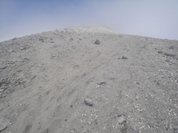
We even got a glimpse far ahead of the final summit we were headed for:
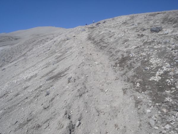
If you look down here, you can see the footprints of previous hikers through the volcanic ash. It really was like hiking through thick sand which can be very slow and annoying to deal with:
Looking across the way as we were hiking uphill at the landscape which we could finally see clearly:
As you can see here, we were actually hiking above the cloud level and emerging into bright sunshine. Earlier it had been cold and rainy outside, but things really started warming up:
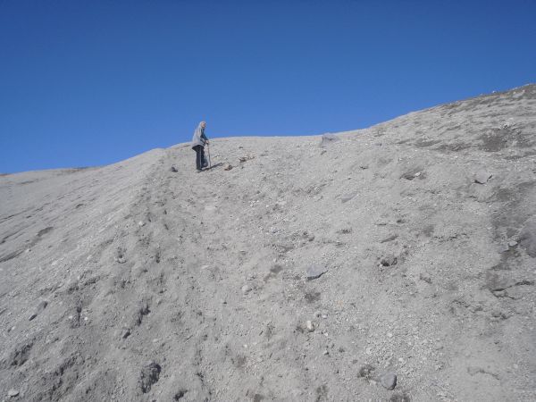
Continuing to make slow progress up towards the summit:
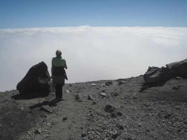
Daria looking out at the clouds. She did an excellent job on this hike handling all the adversity and difficulties we faced:
The next three pictures reveal the final push for the crater rim up through the volcanic ash:
Finally reaching the crater overlook point. The actual summit was still a short distance away:
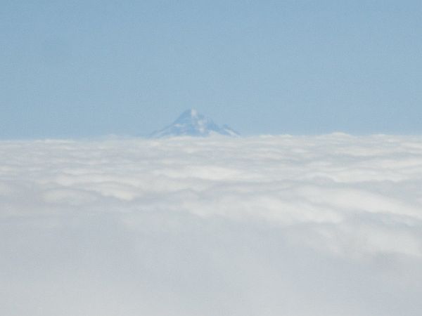
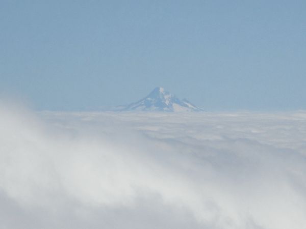
View of Mount Hood 60 miles to the southeast in Oregon:
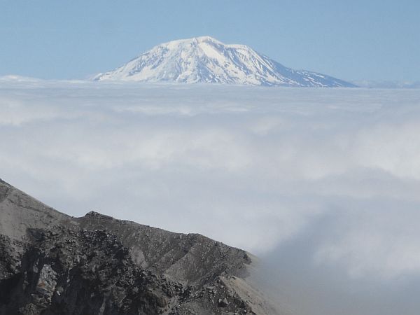
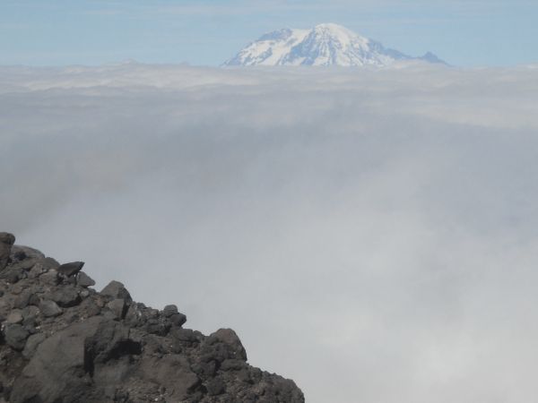
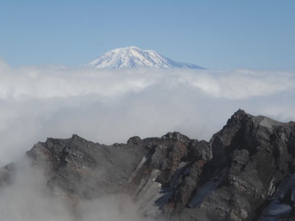
View of Mount Adams 34 miles to the east:
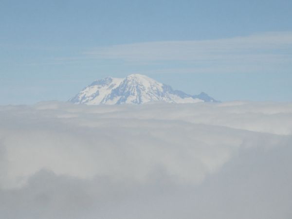
And the grandest Cascade Mountain of them all, this is Mount Rainier 50 miles to the north:
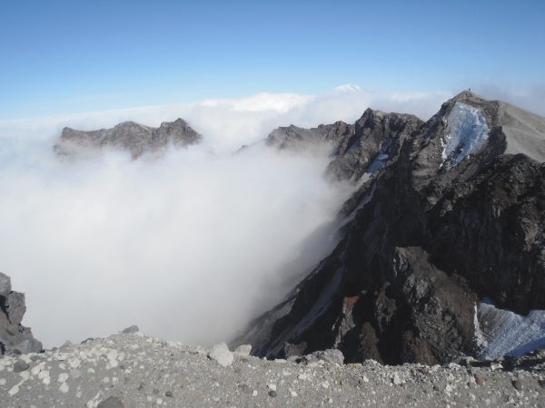
Panoramic to the west along the rim of the crater (click to enlarge):

Panoramic to the east along the crater rim with Mount Rainier (left) and Mount Adams (right) visible. Click to enlarge:

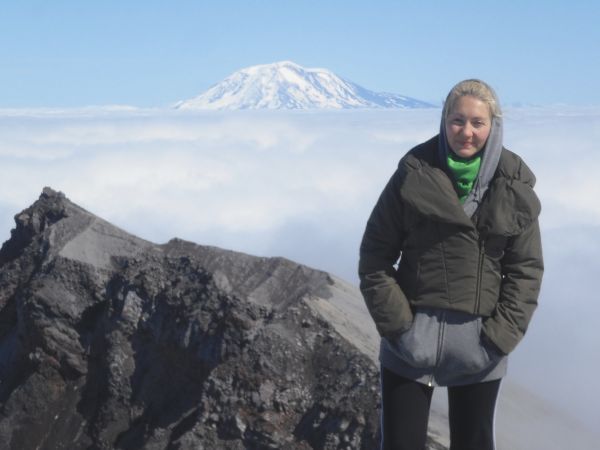
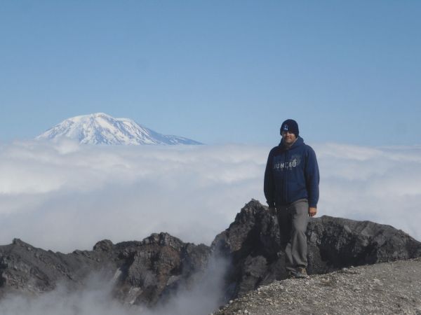
Daria at the crater overlook point with Mount Adams in the background:
Walking along the rim of the crater at the edge of the volcano. Notice to the right there is a thick sheet of ice at the edge (known as cornice). We wisely stayed far away from the cornice and on solid ground. Earlier in 2010, tragedy struck when a climber fell to his death near this very spot. He got too close to the edge for a picture and the cornice broke off, causing him to fall into the crater of Mount St. Helens. We found a thoughtful memorial for him nearby placed by those who loved him:
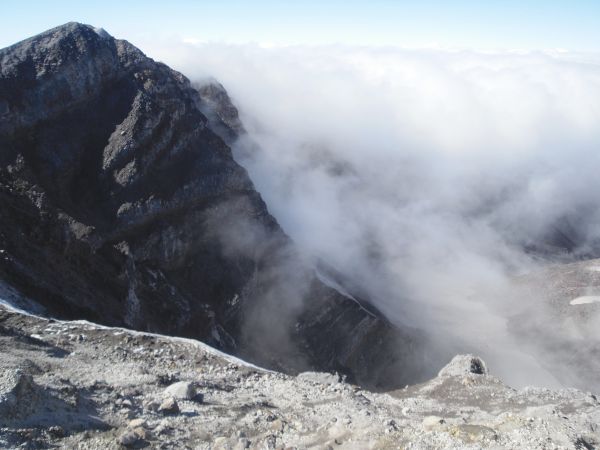
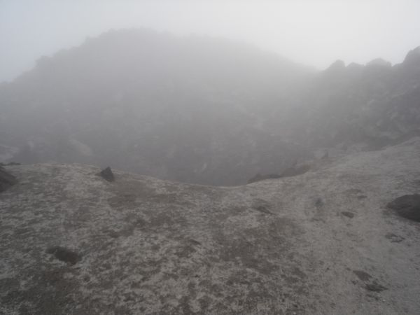
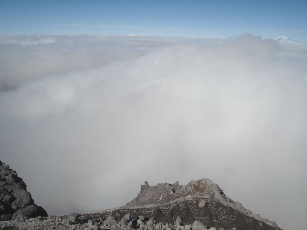
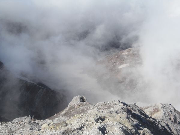
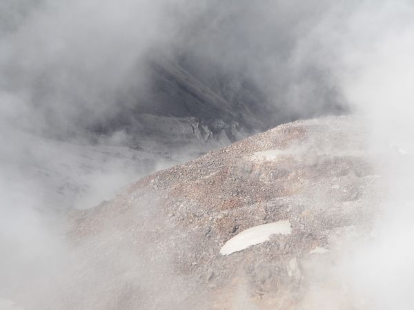
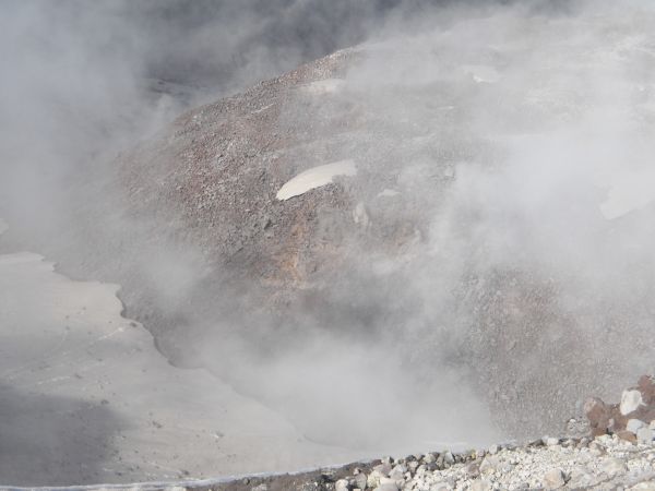
The thick fog began clearing out, allowing for a view into the crater:
We could see the newly formed glacier down in the crater:
Zooming in on the Lava Dome inside the crater of Mount St. Helens:
A nice view of both the glacier and the Lava Dome:
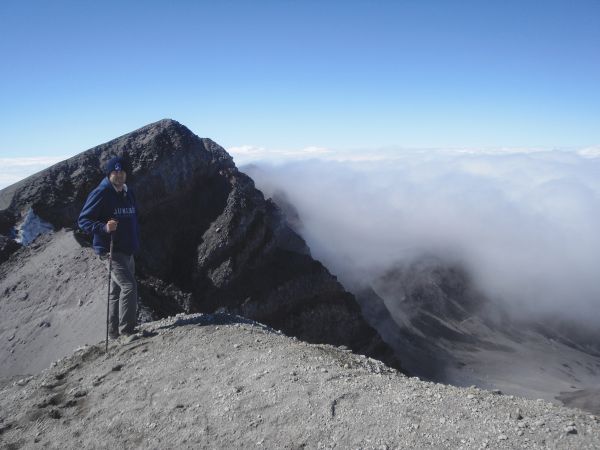
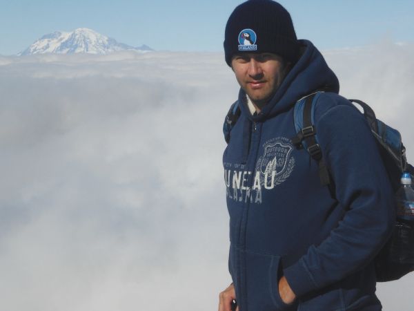
Steve standing on the edge of the crater's rim:
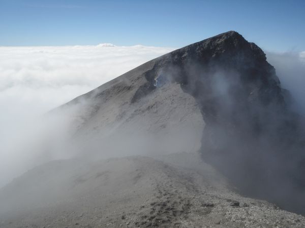
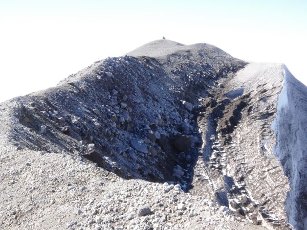
The true summit was close to the high point in this picture, so I began heading for it. I noticed that a majority of the climbers turned around after making it to the crater overlook point:
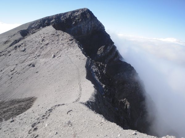
And you can understand why when you see the footprints in this picture, showing the scary path to the summit:
More thick patches of cornice inside the wall of the crater. The Mount St. Helens National Monument site warns climbers about cornices: "The crater rim is precipitous with drops of more than 1,000 feet to the crater floor. A snow cornice develops in winter and often lasts well into summer. Take great care, as portions of the rim may be unstable year-round. Stay off the snow cornice!"


Looking back down the side of the volcano we had climbed up into the thick clouds:
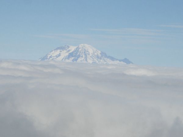
View of Mount Rainier along the way to the summit. Two days earlier we had hiked to Comet Falls in Mount Rainier and visibility was so poor that we couldn't see the mountain once all day. So this was our first view of Mount Rainier:
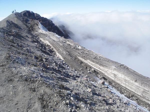
Looking at the rim to the east with some climbers standing on the high point way off in the distance (right side of picture):
Final path to the summit with another huge patch of cornice along the edge:

A small stack of rocks marks the summit of Mount Saint Helens:
View of Mount Hood from the summit:
View of Mount Rainier from the summit:
View of Mount Adams from the summit:
Mount Saint Helens summit picture of Steve with Mount Adams and the volcano rim in the background:
Panoramic view into the volcano crater taken from the summit (click to enlarge):

Steve getting a picture with Mount Rainier before heading down. Mount Rainier is #1 on my To-Do list of all mountain peaks in the world:
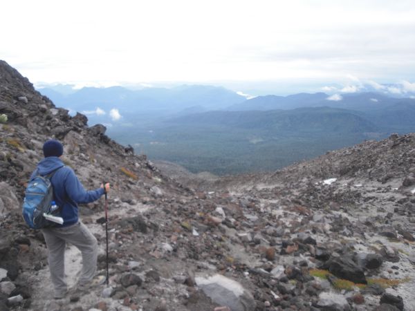
Heading back down Mount St. Helens with increased visibility in the afternoon:
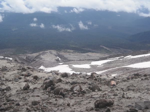
Finally we had a nice view of the area we had hiked through earlier in the day:
Looking across at the permanent patches of snow we passed by:
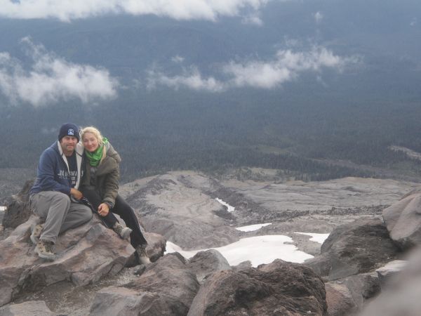
Steve and Daria after successfully reaching the summit of Mount St. Helens on an epic journey never to be forgotten:
Panoramic view of the landscape of Mount Saint Helens taken on our hike down (click to enlarge):

Two pictures showing the unearthly terrain of volcanic ash and lava boulders:
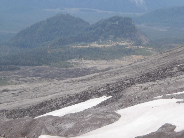
Zooming in on two small peaks down in the forest covered by trees:
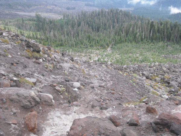
The final six pictures show you the views as we saw them hiking back down: