


Bryce Canyon was a place we had not visited prior to our summer 2012 trip to Utah. Thus, we wanted to stop there and do Bryce Canyon's best hike. After doing some research, it was evident that Bryce's best hike was known as the Figure 8. The Figure 8 hike is basically a combination of the best parts of several other hikes all joined into one. The hike starts out at Sunset Point, which is one of the lookout points along the rim of Bryce Canyon. The 6 1/2 mile hike descends the Navajo Loop trail from there (right fork) into the depths of Wall Street, the closest thing that Bryce has to a slot canyon. After passing through Wall Street we turned right at a junction and then hiked the Peekaboo Loop trail clockwise, passing by the Fairy Castle and the Wall of Windows. The Peekaboo Loop is the bottom half of the Figure 8 (as seen on the topo map below). Upon finishing the Peekaboo Loop, we hiked the Queens Garden trail, stopping by for a picture of Queen Victoria (who appears to be riding a horse backwards). We then climbed back up out of the canyon to Sunrise Point, walked the rim trail back to Sunset Point, and completed our hike just as it got dark out. We were definitely happy with this hike and felt that it showed off some of the best hoodoo scenery of Bryce, a great way to spend our time here.

Bryce Canyon Figure 8 hike mileage information--
Sunset Point to start of Peekaboo Loop via Navajo Loop right fork through Wall Street (1.0 miles).
Peekaboo Loop (3.0 miles)
Start of Peekaboo Loop to Queen Victoria via Queens Garden (1.1 miles)
Queen Victoria to Sunrise Point (0.9 miles)
Sunrise Point to Sunset Point (0.5 miles)
Sunset Point to start of Peekaboo Loop via Navajo Loop right fork through Wall Street (1.0 miles).
Peekaboo Loop (3.0 miles)
Start of Peekaboo Loop to Queen Victoria via Queens Garden (1.1 miles)
Queen Victoria to Sunrise Point (0.9 miles)
Sunrise Point to Sunset Point (0.5 miles)
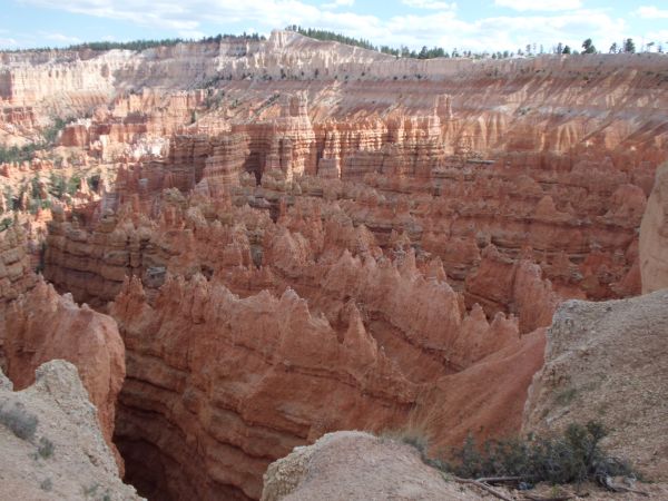
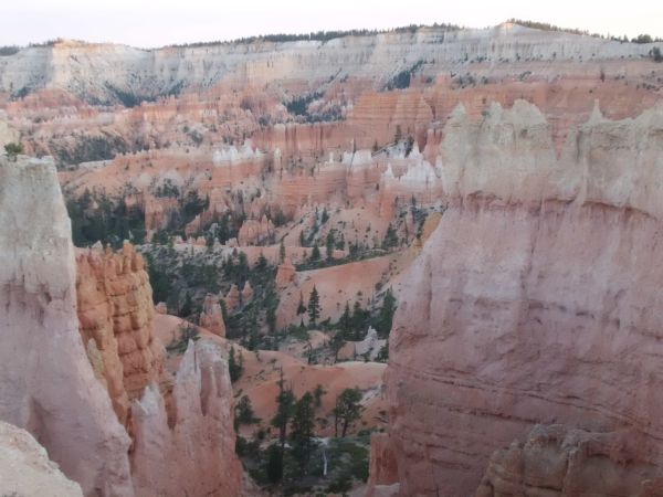
The Figure 8 hike starts out at Sunset Point. This is the view looking down into Bryce Canyon from Sunset Point:
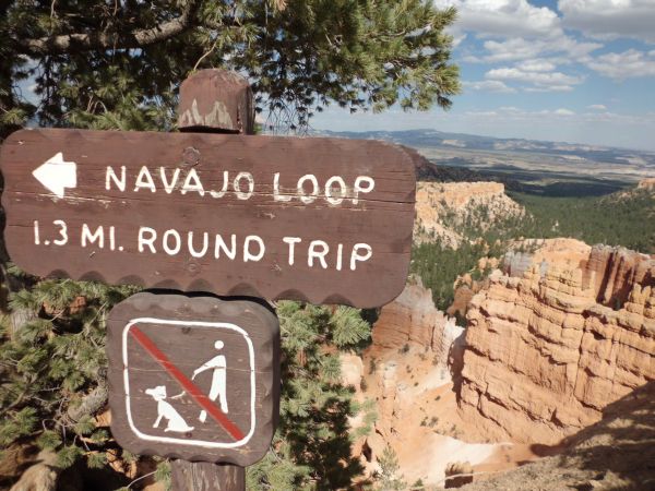
From Sunset Point, we headed down into the canyon on the Navajo Loop trail (taking the right fork down):
The hike starts out with a brief stretch of paved concrete to walk on:


The hoodoos stand out immediately as we drop down into the canyon:

Here we have taken the right fork and are headed down towards Wall Street. Note the hikers in the lower left corner of the photo:

Steep switchbacks drop down from Sunset Point to Wall Street:
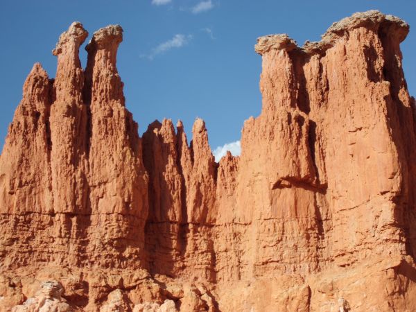
The red and orange rocky cliffs of Bryce stand out early on:

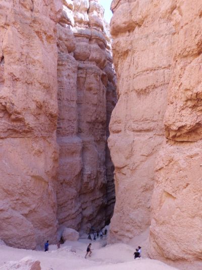
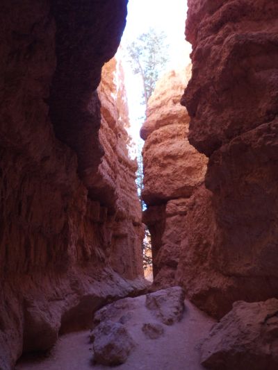
Entering Wall Street, which is busy with hikers going up and coming down:

Wall Street is basically a narrow towering slot canyon that is short in length:
Following the trail down through Wall Street. While we saw lots of hikers in this area, after leaving Wall Street, we only saw a few other hiking groups the rest of the day:

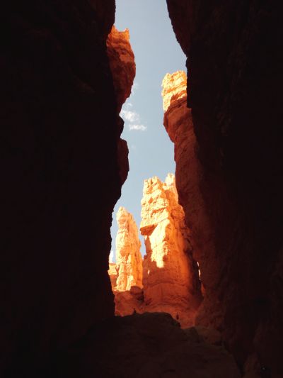
Four more pictures of Wall Street, which show how the tight slot blocks out most sunlight, making for dark passages:


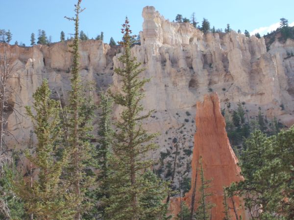
After the trail emerges from Wall Street, it passes through the forest at the base of Bryce Canyon:

The formations of Bryce towering over the trees in the background:
At this point, we turned off of the Navajo Loop trail and followed a small spur trail towards the Peekaboo Loop:


Following the spur trail through the forest:

We then arrived at the junction for the Peekaboo Loop trail. Online sources revealed that it is best to turn left here and do the Peekaboo Loop clockwise in order to see the best scenery while hiking forward:

The trail immediately began climbing, thereby erasing any thoughts that we had of this being an easy hike:

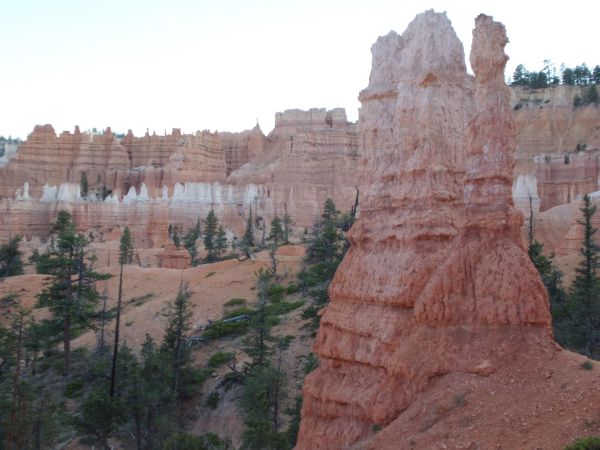
First view of the Fairy Castle, one of the famous landmarks in Bryce Canyon:
We had left Sunset Point somewhere up on that distant ridge about one hour earlier:


Very pretty section of hoodoos which look like they are all lined up in special formation:

Drawing closer to the Fairy Castle, as the trail winds around toward it:

As you can see, this would be a somewhat rugged area off the trail. In order to protect the delicate formations, it is recommended that hikers stay on the trail at all times:
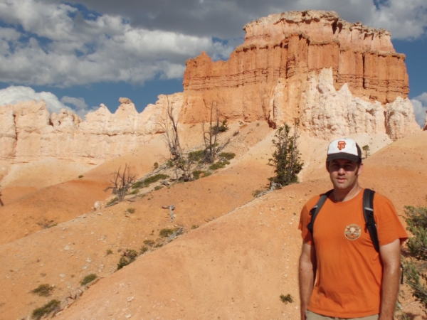
Picture of the sun shining on Steve and the Fairy Castle in the background:

A variety of colors on display, including red, orange, white, and yellow:

In Death Valley, we would call this a pinnacle or spire, but here it is known as a hoodoo due to its composition:

Close-up of the hoodoo pinnacle that we walked by:

The trail continues around past another free standing hoodoo:

Here is a close-up of the one seen in the last picture:
It was a nice day in Bryce, around 90F outside but tempered by the clouds seen in this picture:

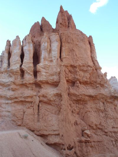
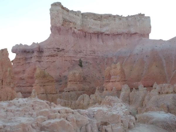
A view of the surrounding hoodoo forest. The bottom of Bryce Canyon is not made up of a flat basin, but rather a series of smaller hills and endless hoodoos:

Impressive series of formations off in the distance:

I suppose if I had to give a nickname to this area I would call it The Skyline:
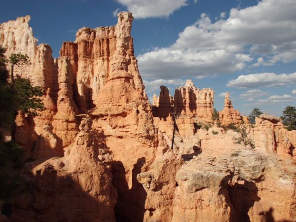
Breathtaking scenery from all along the Peekaboo Loop trail:
A series of thick hoodoo formations seen here:


These formations are mostly tall and thin:

Catching an early glimpse of one of the openings in the Wall of Windows:
Steve passing through the forest and Claron Formation of Bryce Canyon:


The forest setting of the formations makes them even more beautiful:

Bryce Point is visible in the top center of this picture. Yep, that's a lookout point up there with a railing:
Notice the lines of erosion near the bottom of this formation, creating a pattern:
A single hoodoo spire sticking out of the trees:
Full view of the Wall of Windows about halfway through the Peekaboo Loop:


View from a little farther back showing how the trail circles around below the windows:

Picture of Steve with the Wall of Windows in the background:

More incredible formations nearby just past the windows:
Standing directly below the Wall of Windows, one of Bryce's famous spots:


Up high once again, we could see past Bryce Canyon and to the mountains in the distance:
What looks like dripping mud near the bottom center of the picture:

Close-up view of the left window after we had walked past it:

An impenetrable blockade of hoodoos in the distance:

Another arch or window up on the hillside in white-colored rock:

The Peekaboo Trail had lots of ups and downs. Mel is seen here taking it slow up another long set of switchbacks:

The rewards for gaining elevation were always worth it-- amazing views:

Two views of an impressive towering formation we passed by:


Even better views with the afternoon sunshine lighting up Bryce:

The trail passes by a couple of hoodoo columns on each side:
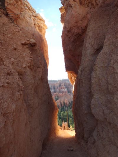
The trail passed through a couple sections of rock like this. I couldn't help but wonder if these openings occurred naturally or if they were blasted out decades ago when the trail was constructed:

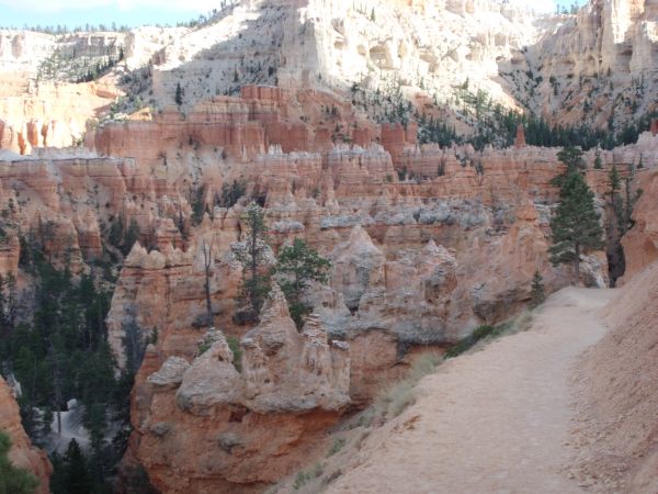
High above the amphitheater of Bryce Canyon and forest floor:

Formations glowing in the sunshine bright orange:

The trail then descended back to the forest floor and start of the Peekaboo Loop section of the Figure 8 hike:
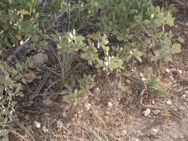
A short time later we came across this snake which was basking in the sun on the trail. As we approached, the snake moved off into the bushes:

Upon completing the Peekaboo Loop of 3 miles, we then began the upper half of the Figure 8 on the Queens Garden trail:

You can see why this is a "best of Bryce" hike. The scenery continued to amaze us:

Hoodoo columns standing hundreds of feet in the air:

Upon reaching the Queens Garden, where Queen Victoria is overlooking her garden of rocks, we found this sign and survey marker:

The Queens Garden was the most impressive and compact section of hoodoos we passed by:

If I had to name this formation, I would call it the Broccoli Stem, as it's only missing the crown:

Very small window in what looks like the facade of a castle or medieval estate:

Another series of unique hoodoo formations in the Queens Garden:

The next three pictures show additional scenery found in the Queens Garden area:


Stop here for a moment and study this picture closely. Can you pick out Queen Victoria? She can be seen somewhere in this picture. She is riding an animal:

Here is Queen Victoria, very aptly named. Notice her crown and facial features. Also, how she is riding a camel or horse backwards:

Another picture of Queen Victoria, taken from directly below her:
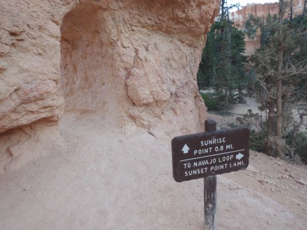
Time to move on to another section of the Figure 8 hike. Now we are hiking back up to the rim and Sunrise Point:
The trail winds slowly back up to the rim, a lot less steeply than the Navajo trail we took down:


This almost looks like a giant hand or glove sticking out of the ground:

Passing by more formations during the gradual ascent up to Sunrise Point:

Sunset over Bryce Canyon on a hot summer day:

Four more views of Bryce as we climbed back up to the rim:

Finally arriving at Sunrise Point, which is another overlook point. From here it is a half mile walk to reach Sunset Point and complete the Figure 8:

And we leave you with a panoramic view of Bryce Canyon (click to enlarge) from Sunrise Point: