

In the Summer of 2009, I began searching for destinations in Death Valley National Park which were summer alternatives to Telescope Peak. One of the main criteria I was looking for was that a hike would have to start above 6,000 feet, which would mean the temperatures were less likely to be life-threatening intense heat. I came up with a number of options, including the idea of reaching the summit of Tin Mountain by hiking cross-country from White Top Mountain. However, on that July 2009 trip, we were unable to attempt the planned day hike, due to a flat tire which we got early in the trip. Fast forward one year later and in August of 2010 we were again looking for an alternative summer destination. Thus, I once again took a look at this hike and realized it was better suited as a backpacking trip. The drawback I realized would be that I would need to pack 2 days worth of water and carry that with me, while dealing with potential temperatures of 90 F plus. After monitoring the weather in Death Valley for about a week, our group of four (including myself, a fellow hiker, Kirk, and Patrick) set out on our White Top Mountain to Tin Mountain backpacking loop. The route which I came up with was both ambitious and original, and it included some visits to essentially unknown areas which have never before been reported on publicly. Our backpacking trip turned out to be a complete success, despite the various obstacles and challenges we had to overcome along the way. Because the route was extensive and there is a lot to show and tell you about, this report has been split into two parts. The first part covers the first day of our journey, as we progressed from White Top Mountain to Tin Mountain. The second part will cover the second day of our journey, as we completed our loop back. You can read the second part by visiting the Trip Report for O'Brien Canyon.
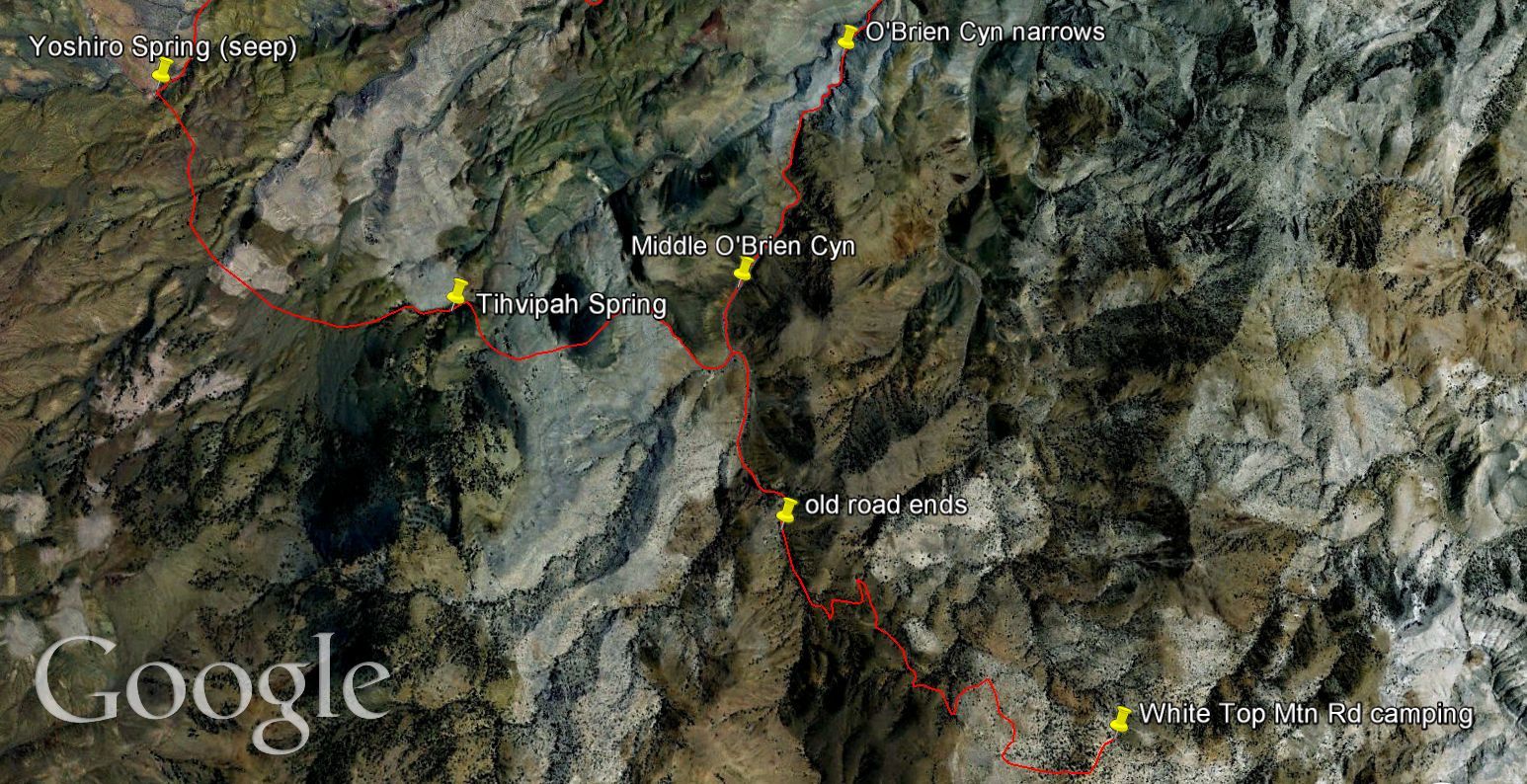
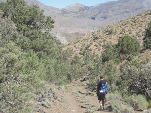
On Day One, we began our journey at the crest of White Top Mountain Road. The night before we had camped under some nice trees in a wide clearing by the side of the road. The hike began by walking down a spur road off of White Top Mountain Road, which heads to the northwest down towards O'Brien Canyon. The downhill walking on the road was easy, but it was made difficult by the 40+ pounds of water which I was carrying. In fact, for the two days of backpacking, I was carrying a personal record 672 ounces of water. That's 5 gallons and 32 ounces if you were wondering. We had to carry so much water because we were assuming that there would be no surface water at the three springs we would be visiting along the way and it was summertime. And the springs were set to be one of the highlights for the trip. We wanted to fully explore the three springs which were listed on topo maps, to see what they were like and what kind of scenery and wildlife might be in the area. The three springs we visited (in order) included Tihvipah Spring (listed on topos as Spring), Yashiro Spring (listed on topos as Seep), and Bighorn Springs (twin springs listed on topos as Spring). You can see our full route and the location of the three mysterious springs by looking at our Google Earth maps below. (Note: click to enlarge all three of the Google Earth maps for a better view of our entire route.)
On Day One, we began our journey at the crest of White Top Mountain Road. The night before we had camped under some nice trees in a wide clearing by the side of the road. The hike began by walking down a spur road off of White Top Mountain Road, which heads to the northwest down towards O'Brien Canyon. The downhill walking on the road was easy, but it was made difficult by the 40+ pounds of water which I was carrying. In fact, for the two days of backpacking, I was carrying a personal record 672 ounces of water. That's 5 gallons and 32 ounces if you were wondering. We had to carry so much water because we were assuming that there would be no surface water at the three springs we would be visiting along the way and it was summertime. And the springs were set to be one of the highlights for the trip. We wanted to fully explore the three springs which were listed on topo maps, to see what they were like and what kind of scenery and wildlife might be in the area. The three springs we visited (in order) included Tihvipah Spring (listed on topos as Spring), Yashiro Spring (listed on topos as Seep), and Bighorn Springs (twin springs listed on topos as Spring). You can see our full route and the location of the three mysterious springs by looking at our Google Earth maps below. (Note: click to enlarge all three of the Google Earth maps for a better view of our entire route.)


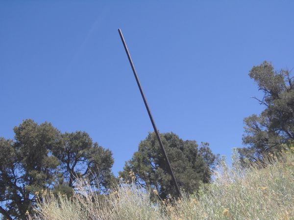
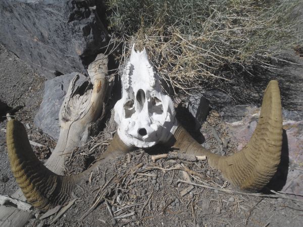
After hiking all the way down to the end of the spur road, we continued following a couple of side canyons down towards O'Brien Canyon. We eventually crossed over O'Brien briefly and took a drainage back up the other side to gain our elevation back. We then climbed a bit more and did a semi-circle around to Tihvipah Spring. Tihvipah Spring was very interesting. There was no evidence of any surface water, but there were definitely some trees and bushes being fed by underground water. There was also a large 20 foot tall pole sticking out of the ground and we came across innumerable pheasants which were making the spring their home. We next continued circling around towards Yashiro Spring, all the while doing some minor ups and downs as we would cross over drainages. Yashiro Spring had a highly spectacular setting, right up against some towering rock walls. We sat down in the shade of these walls to enjoy our lunch. We did indeed find a seep of water at Yashiro, in the form of a small pool located right below a marker that somebody had placed a long time ago. Something else peculiar we found was a small graveyard of bighorn sheep. Approximately 5 bighorn sheep all appeared to have died in the same area, as we found their skulls, horns, and bones right next to each other. After spending some time at Yashiro Spring, we crossed over to the canyon which follows along the southern base of Tin Mountain. As had been the case several times already, we were able to follow a relatively clear sheep trail to get there. About 20 minutes later, we found a nice rock wall directly in the middle of the canyon where we decided to drop our full size backpacks for the day. This would be where we would camp later that night. But our day was not finished. We then proceeded to take our day packs with water and food, and head up to attempt a summit of Tin Mountain. The journey was long as we passed countless Joshua Trees and went up and down more drainages, and then crossed through a beautiful flat valley filled with full size shade trees which brought us relief from the heat. Then we began our final ascent by following a long ridge up the mountain until we could finally see the summit of Tin off in the distance. As majestic views came into sight, we reached the summit at sunset, around 8pm. We stayed on Tin Mountain long enough to sign into the register and get some nice photographs. I kind of doubt anybody has ever taken sunset photographs from the summit of Tin Mountain, but that's what we ended up doing. It took us nearly 4 hours to hike back down to our camp for the night, as we were only sharing two flashlights for four people. We took a slightly different route back in the dark, using two canyons which could have ended in impassable dry falls, but fortunately did not. Patrick's GPS along with my instincts helped guide us back to camp, where we happily went to sleep for the night, ready for our great adventure to continue the next day.
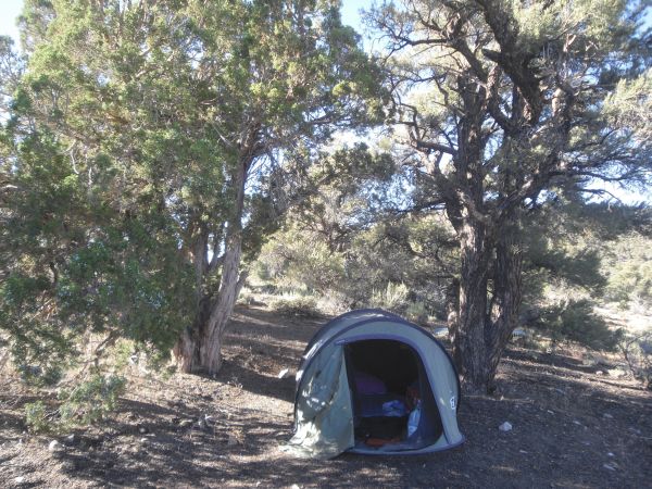


We camped the night before near the crest of White Top Mountain Road in this clearing:
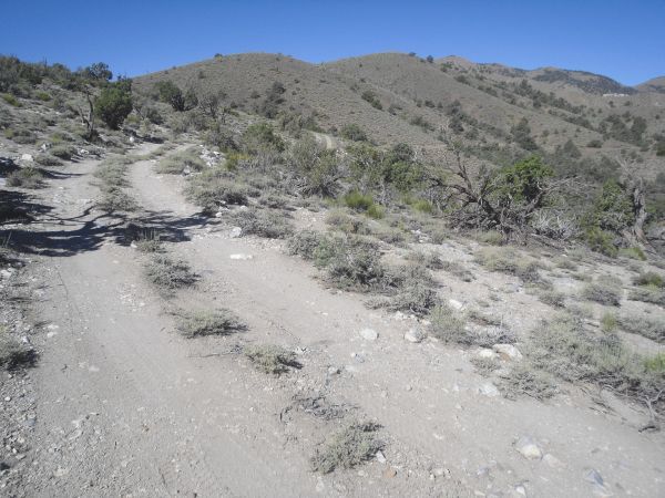
Beginning our backpacking trip by following this 4wd spur road at around 7,000 ft in elevation:
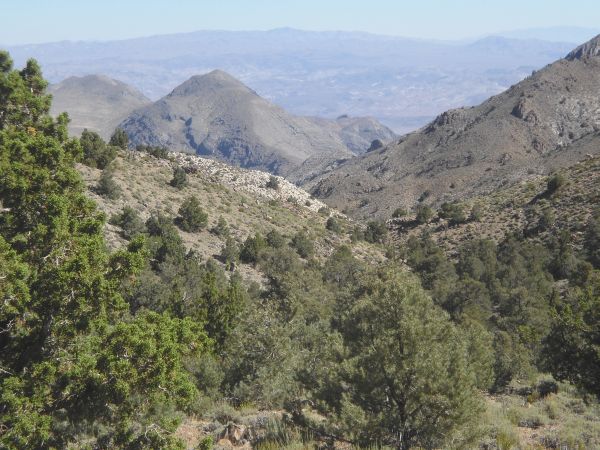
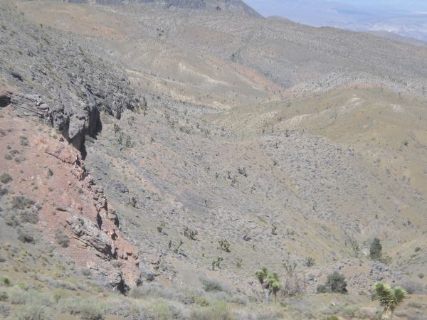
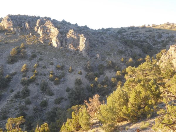
The next two pictures show views that we had along the spur road looking down towards the head of Bighorn Gorge:
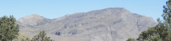
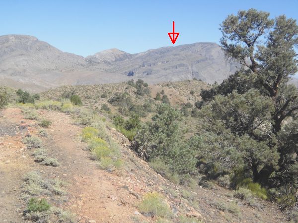
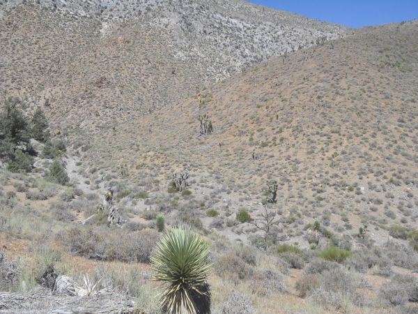
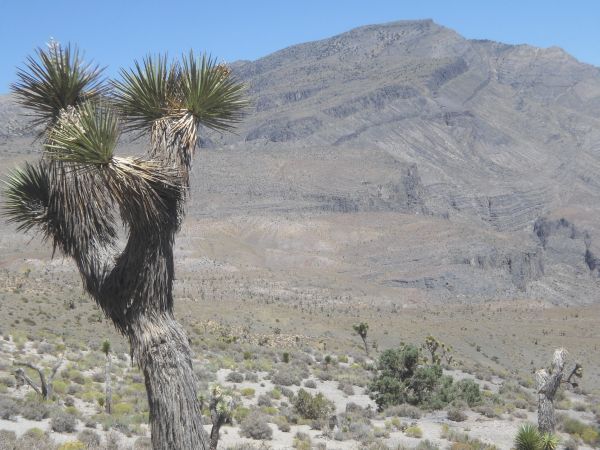
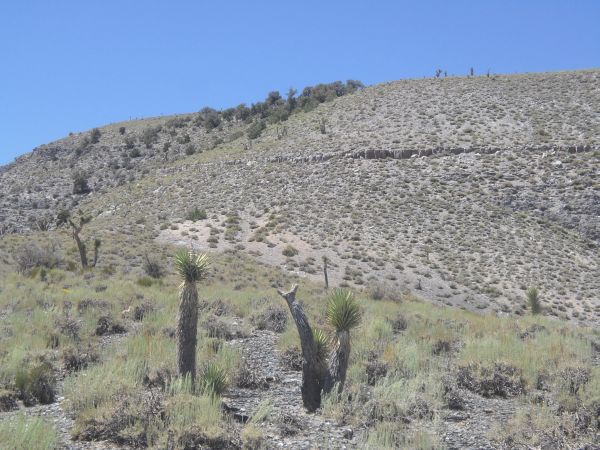
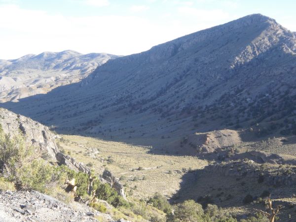
The true summit of Tin Mountain was not very visible during most of our hike, but in this picture you can see its actual location (as a faint bump):
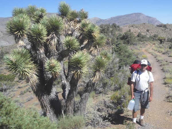
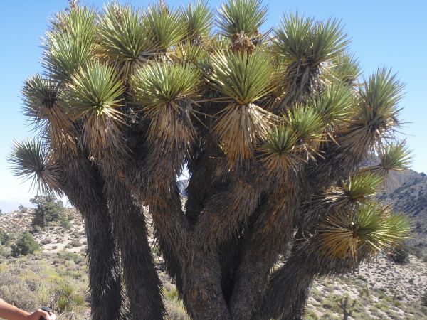
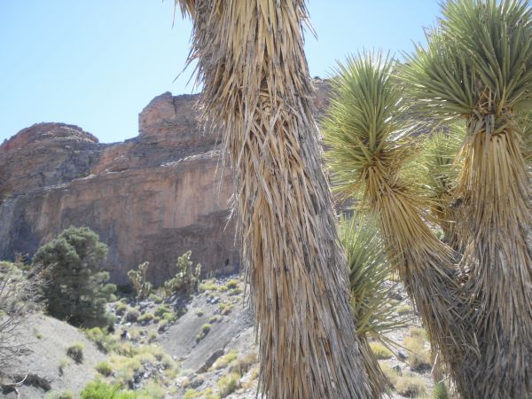
Steve and Joshua Trees in the next two pictures, taken along the spur road:
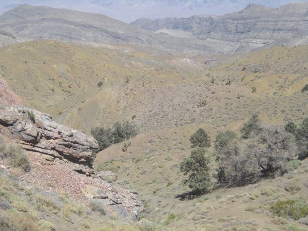
The spur road stayed level for a while and then began a rapid descent. Visible off in the distance is the ultimate route we would take towards Tin Mountain later in the day:
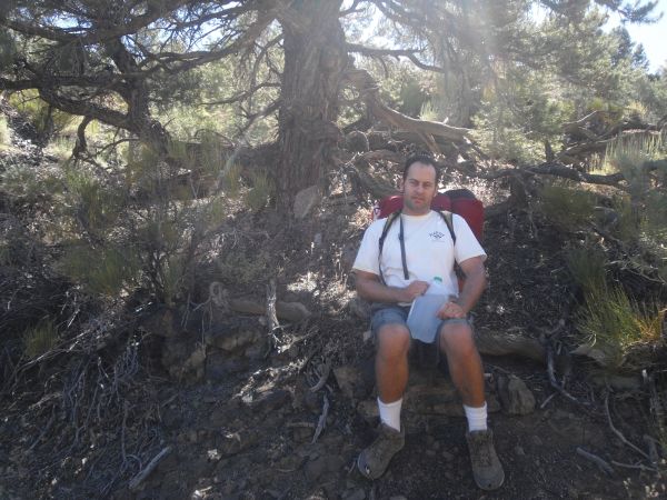
Whenever possible, all of our breaks were taken in the shade. It was hot outside, slightly above 90 degrees F. The only relief came from the shade trees and an occasional blast of cooler wind:
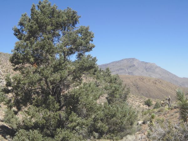
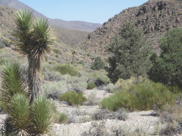
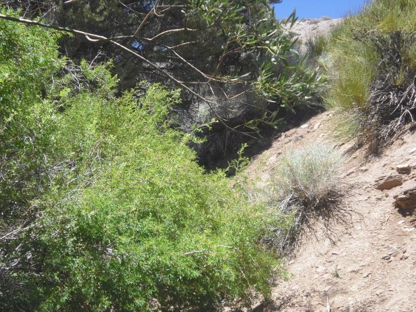
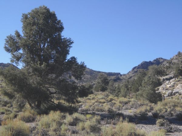
Notice the variety of trees which we greatly appreciated in the next two pictures, as the road ended and we began the cross-country portion:
Here we are crossing over into Upper O'Brien Canyon. But not for long, as we are going to be heading up the slot to the right:
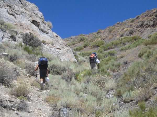
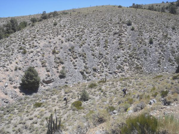
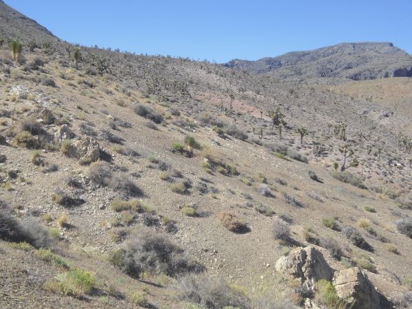
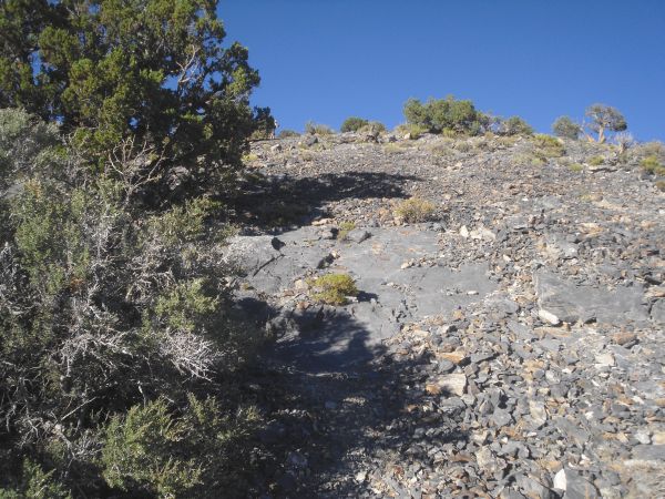
Backpacking up the drainage to gain back our elevation. This was a really tough climb, in view of the heat and weight in water we were carrying:
Almost to the saddle, where it would be a relief to be able to rest for a few minutes:
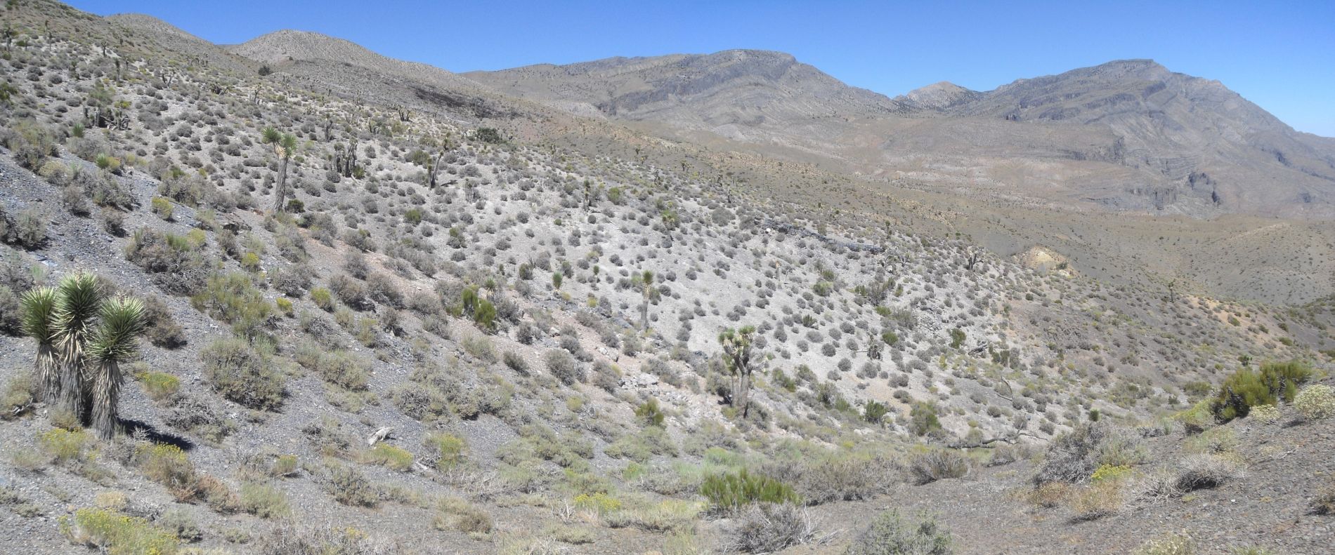
Next we would have to head uphill along the terrain on the left side of this panoramic picture (click to enlarge):
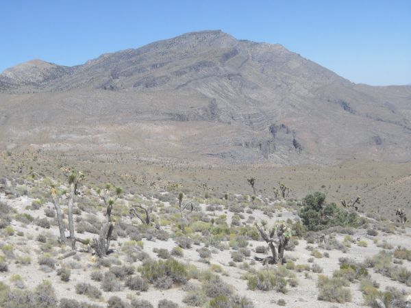
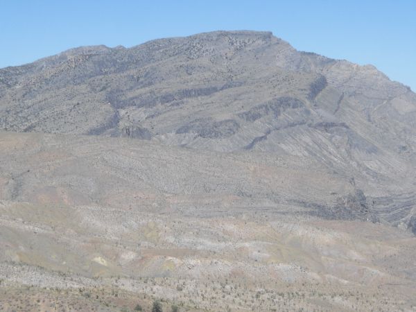
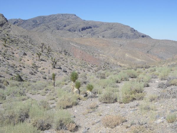
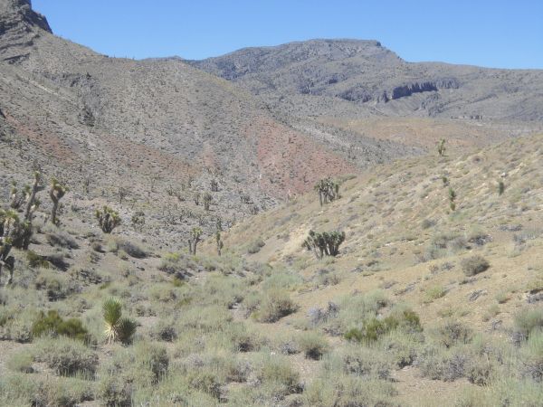
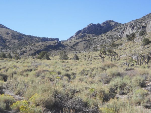
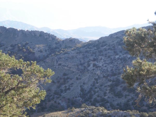
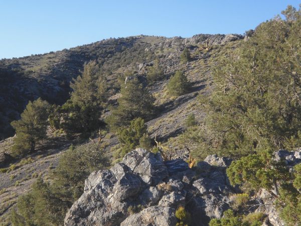
The next two pictures show a close-up and wider view of Tin Mountain and the surrounding landscape we were admiring:
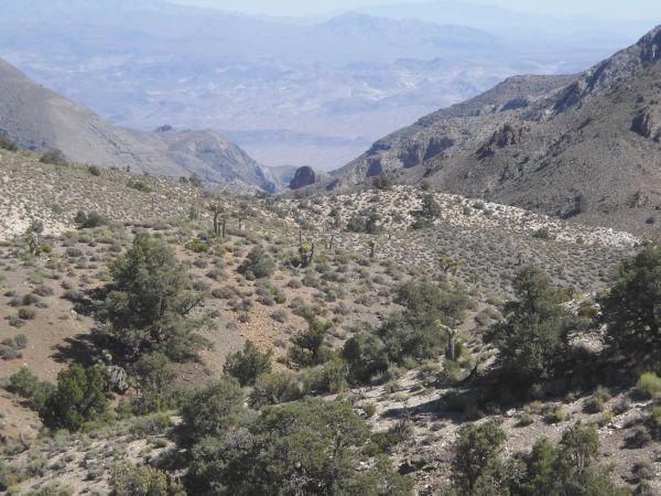
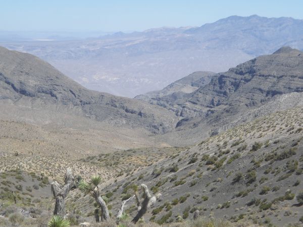
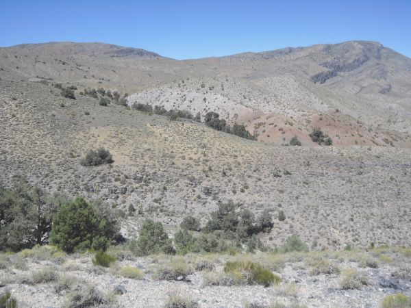
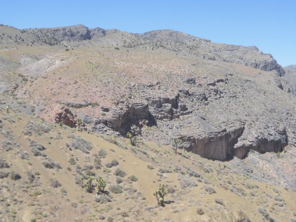
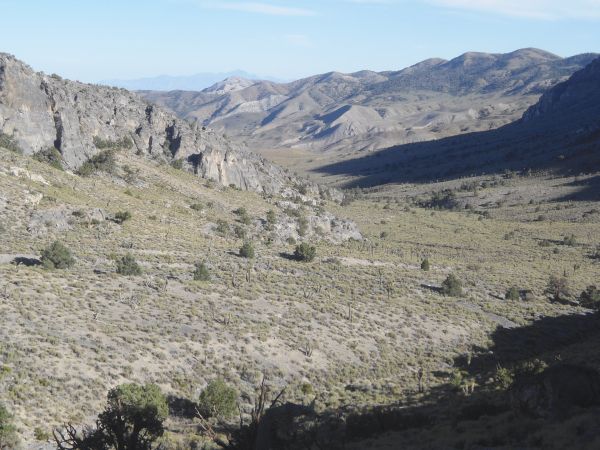
Looking down towards the head of Bighorn Gorge from this spot, which would be a destination set for the next day:
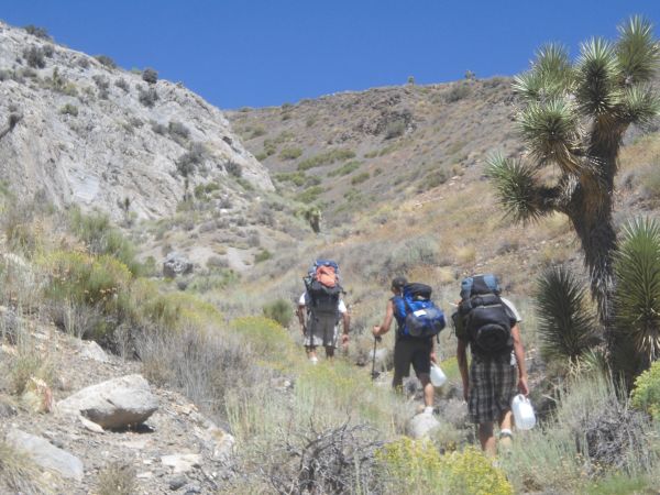
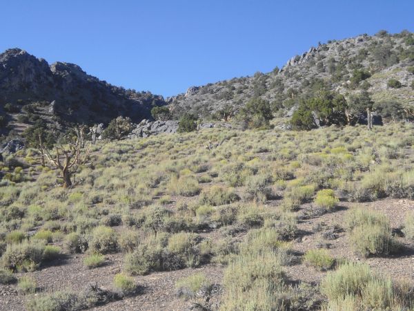
Some more uphill without too much shade, as we needed to get to the top of this ridge on the right:
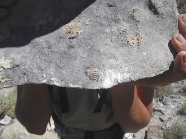
Kirk proved to be good at discovering numerous fossils along the way, including this one preserved in a slab of stone:
Off in the distance we finally caught sight of Tihvipah Spring at the bottom of some reddish-white hills:
We always had a good view of Tin Mountain, although at this point we did not realize where the true summit was:
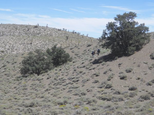
The guys crossing below a rocky hillside on their way to the first spring:
Two views of Tihvipah Spring, which was our first important destination along the route:
We immediately saw some greenery at the beginning of Tihvipah Spring:
The brush was thick, so we had to navigate through it and around it:
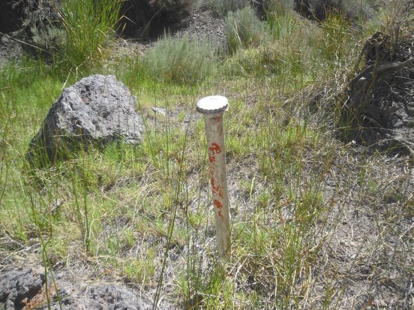
This towering pole was sticking out of the ground, marking the location of Tihvipah Spring:
Pushing our way through the brush before startling countless pheasants:
Patrick ahead continuing our journey on to the next spring:
Looking back at the guys as they took a short break:
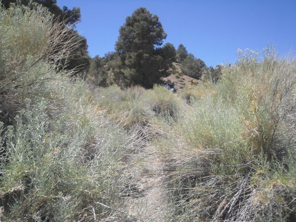
We would have to go up and down some drainages in order to reach the next stop:
Looking downhill at the scenery from this location in between the two springs:
Our next stop was going to be Yashiro Spring, which was at the base of the cliffs up ahead:
In the next two pictures, we are making our way down to Yashiro Spring:
Yashiro Spring was located at the base of this rock wall. Notice also the bare tree in the upper left of the picture:
The guys sitting down in the shade of the towering rock wall to enjoy some lunch:
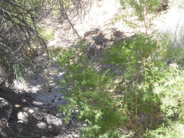
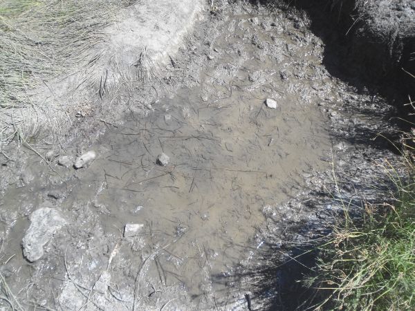
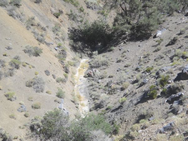
There was lots of grass growing at Yashiro Spring, and a pool of seeping water:
Definitely surface water, but I wouldn't want to drink it unless I was dying:
This was the marker at Yashiro Spring, also labeled as "Seep" on topo maps:
More of the grasses at Yashiro Spring:
The rock wall was quite massive and had an interesting texture and colors to it:
This bighorn sheep skull has obviously been here a long time, as it is partially buried in the dirt:
Steve getting a picture by the eerie bighorn sheep graveyard area:
Looking back at the rock wall cliffs as we began crossing over to another canyon:
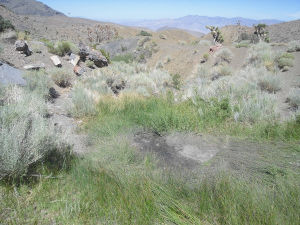
Looking down at Lower Yashiro Spring. Based on the way the ground looks, water has been flowing not too long ago:
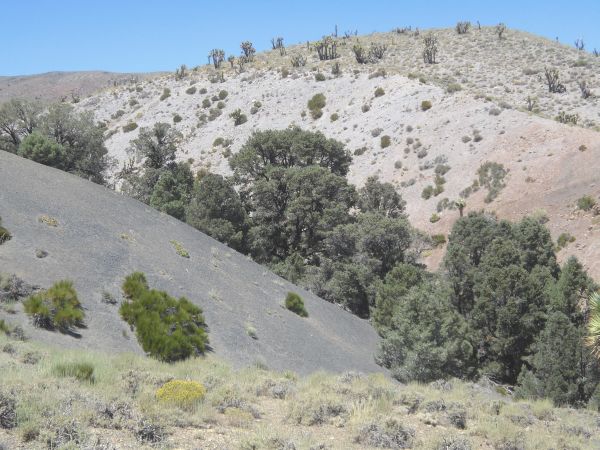
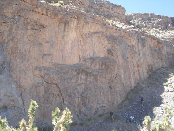
In the next two pictures we crossed over from the canyon which starts at Yashiro Spring to the canyon which follows the base of southern Tin Mountain:
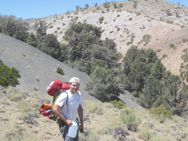
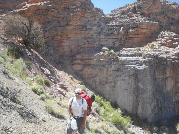
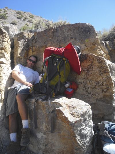
This is the picture of the day, as Steve sits back in a corner desperate for some shade and rest. We would drop our packs here, head up Tin Mountain, then return later to camp here for the night:
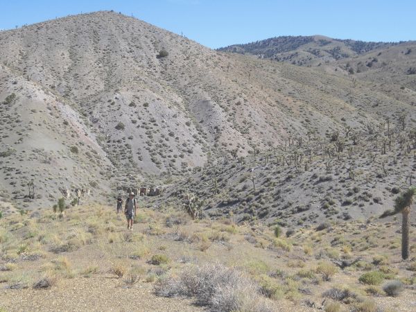
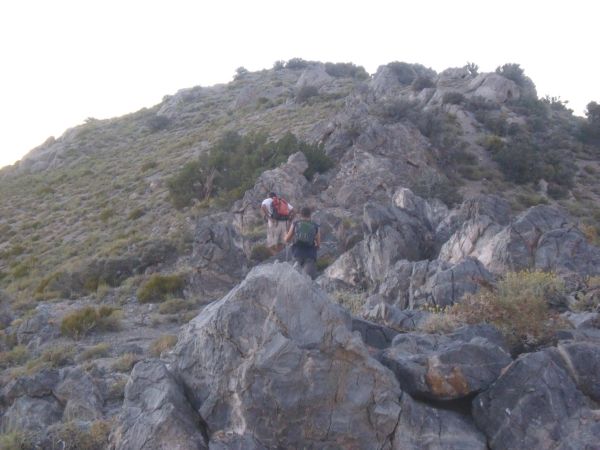
The guys heading up from our camping spot to begin the climb up Tin Mountain:
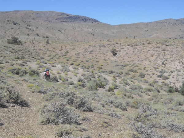
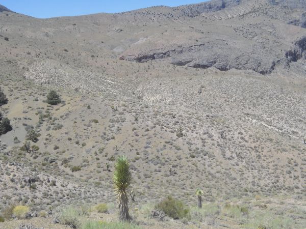
It was about four miles from our backpack drop point to the summit of Tin. To start with, we headed uphill while dealing with some drainages:
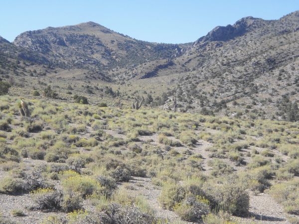
Eventually we came out into this flat valley which gave us a much needed break from difficult hiking:
Heading through the valley hiking from shade tree to shade tree:
The valley had some pretty scenery. Up ahead you can see the small hill we climbed to begin our ridge climb of Tin Mountain:
Looking back down at the valley we passed through:
It was a gradual ascent on the ridge at first, but it would get steeper later on:
A huge peak casting a shadow across the valley we had passed through earlier:
Soon the hiking got a bit steeper and harder to deal with:
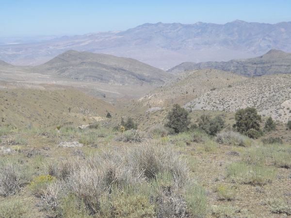
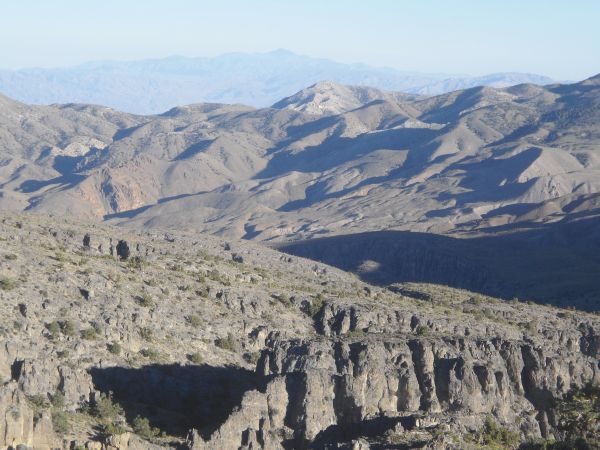
We could tell we were gaining some good elevation once we could see across the other ridge into Racetrack Valley:
An awesome view looking back at White Top Mountain and Telescope Peak far off in the distance:
What an incredible view we soon had of The Racetrack and Ubehebe Peak:
First appearance since the beginning of the day of the true summit of Tin Mountain. Up until this point, we weren't sure where the summit was or if we would be able to make it:
We had to circle around to the right and reach the final ridge shown in this picture:
From there, it was simply a matter of pushing ourselves to climb the final portion to the summit:
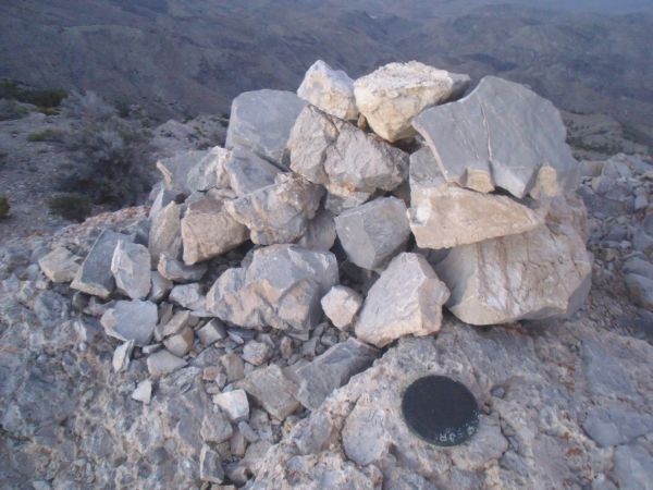
Indeed we made it to the summit of Tin Mountain just as the sun was setting:
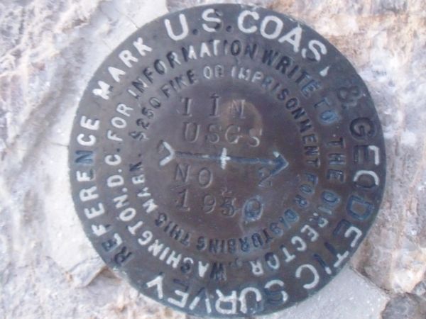
Benchmark at the summit which says the name Tin:
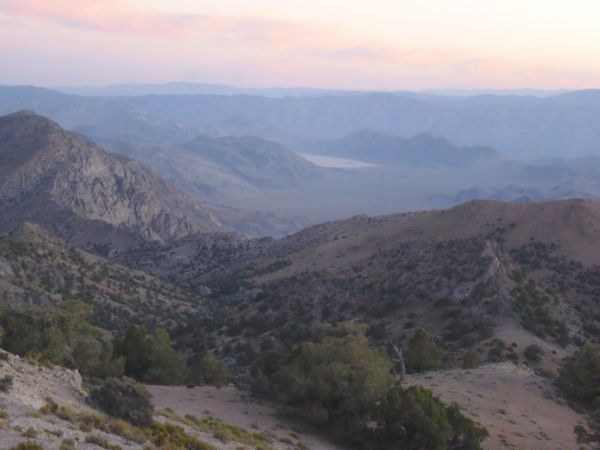
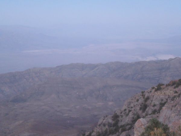
Sunset view of The Racetrack from the summit of Tin Mountain, looking to the southwest:
Looking due west from Tin Mountain at the Dry Mountain peak:
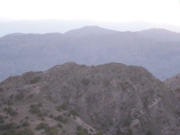
A grand view to the north from the top of Tin Mountain:
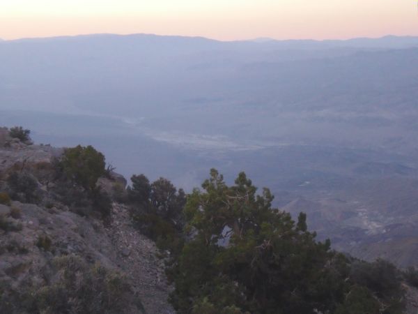
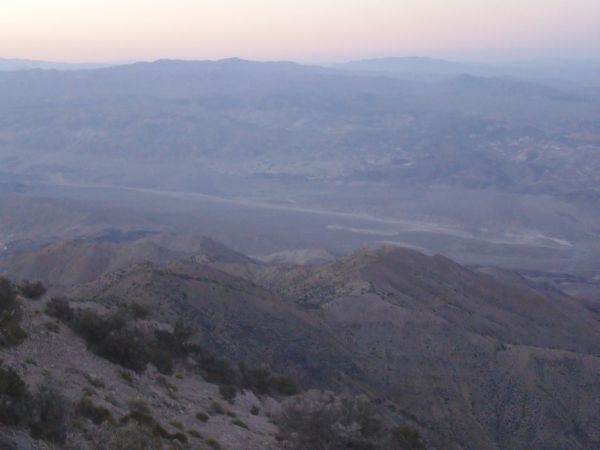
Looking towards the east with Grapevine Canyon far below:
Looking to the southeast into Mesquite Flat and central Death Valley
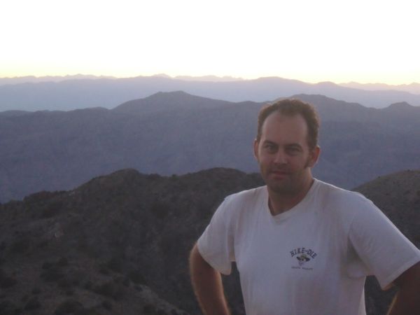
Since I had to choose a spot for my summit picture, I decided to go with the view of Dry Mountain, being that it was the single most challenging day hike of my life (even harder than Mt. Whitney):
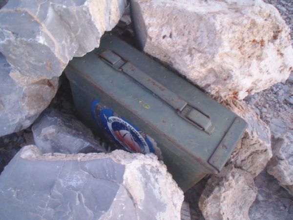
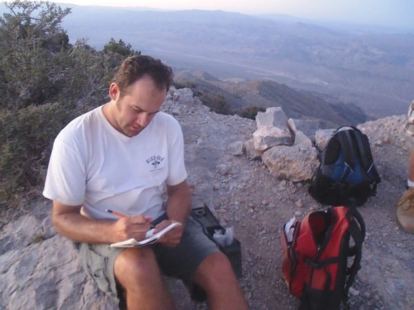
One final thing to do on the summit, which was logging in to the register:
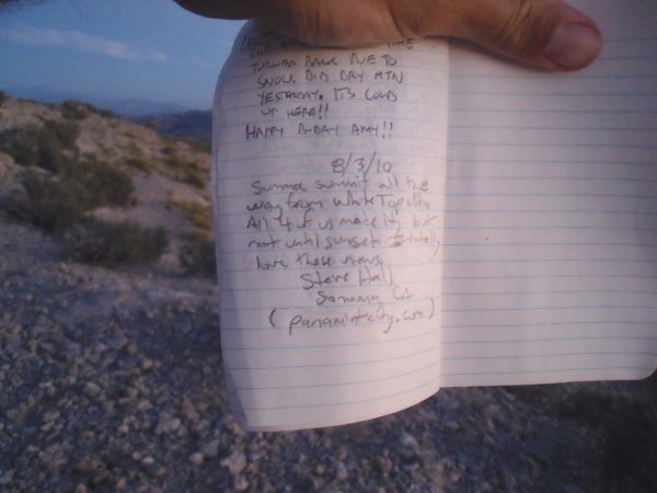
The final two pictures of the day taken on August 3, 2010 show Steve signing into the register on the summit of Tin Mountain at 8,953 feet. Our backpacking trip continues with part two under the O'Brien Canyon report: