
MAPS

OVERVIEW
Cottonball Marsh is a seldom-visited area of wetlands located south of the Salt Creek parking lot which contains beautiful formations and somewhat hard-to-find pools of rare pupfish. Difficulties encountered on the hike include dealing with long stretches of flat but brutal terrain to reach West Side Borax Camp and carrying out a successful search for pupfish pools while not damaging the fragile formations and ecosystem. Detailed route maps and GPS coordinates of pupfish pools are not provided in order to avoid a large amount of increased visitation to this area and to protect fragile formations. A topographical map of the general area can be found by clicking on the button above. GPS coordinates for the western edge of Cottonball Marsh near West Side Borax Camp are 36° 30.433'N, 116° 59.468'W.
OUR VISIT
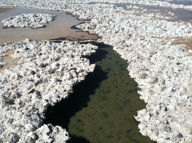
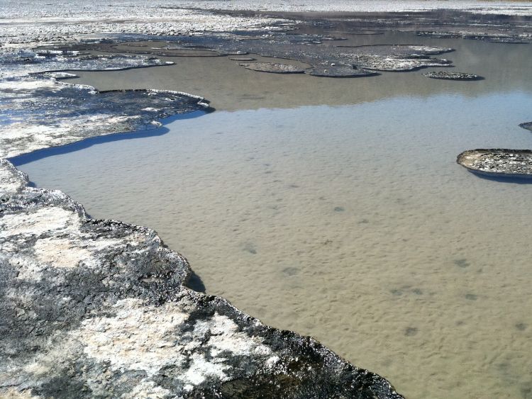
Cottonball Marsh is not a frequently visited or widely discussed area within Death Valley. The marsh itself, as seen on topographical maps, measures about 1 1/2 miles in width by 2 1/2 miles in length. Reaching the marsh and fully exploring it is an incredibly difficult endeavor. For several years, I had been hoping to hike out to Cottonball Marsh to explore the basin and marshlands. What held me back was being unfamiliar with the area and the complete lack of information available. About the only thing I had heard was that the Cottonball Marsh pupfish (Cyprinodon salinus milleri) were there and they were hard to find. In looking at the topo map (linked to above), I realized that Cottonball Marsh covered a vast area and trying to find a few small ponds with pupfish could possibly be like searching for a needle in a haystack. My thoughts on this were confirmed by an NPS staff member who informed me that it generally takes a minimum of three days of searching in order to find the pupfish pools (or ponds). What I didn't realize beforehand, though, was that the terrain to get to Cottonball Marsh was some of the worst and most painful for walking across in the entire park. In addition, once you have reached Cottonball Marsh the terrain takes a turn for the worse and you can find yourself sinking ankle or knee deep into slimy muck at times.
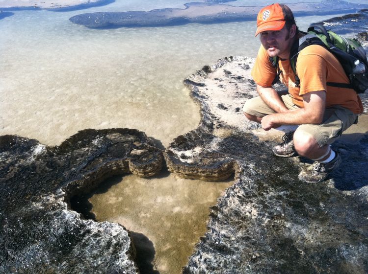
On March 10, 2011, our group set out from the Salt Creek parking lot to finally hike out to Cottonball Marsh for the day. We hiked south close to the base of the Salt Creek hills until we found a low opening in them and passed through heading west. Eventually we ended up finding the old closed road and hiked that for part of the way. Up until this point, everything was great. Then the road gradually disappeared and the terrain began getting rougher and rougher. Soon, progress was slowed to a crawl and every step across the rocks and muddy salt formations was painful. There were at least four separate times when our group got into a debate and we seriously questioned what we were doing on this hike and whether or not we should turn back. And the whole time, water was not visible. We wondered if Cottonball Marsh had dried up. But we pushed on despite the increasing heat and negative feelings, and finally made it out to the old West Side Borax Camp site. From that spot, we could see where the first spring emerged and several pools of water sat out on the basin. The hike had been nearly 8 grueling miles so far. As we walked out to the first few pools which were visible, we realized that we could see more and more out on Cottonball Basin. The more we hiked, the more marshy pools became visible. This cycle continued and we finally realized how vast of an area Cottonball Marsh covered. During the course of our day, we were fortunate to stumble across the pupfish pools by pure chance. If we had not happened to hike in a certain direction at the exact time we did, we would have missed them. I'm still not sure how we pulled it off so perfectly, but we did. I can honestly say that the Cottonball Marsh pupfish pools are one of the most beautiful areas I have ever seen in my entire life. These pristine pools and the delicate ecosystem connected to them are extremely special and amazing, more so than the most beautiful pond ever built in someone's backyard. I've never seen anything quite like it. Pools up to 4 feet deep of crystal clear water with schools of Cottonball Marsh pupfish swimming through channels into the ponds and then disappearing under into hidden areas. We literally saw hundreds of Cottonball Marsh pupfish. As of updating this report in late 2015 (nearly five years after our visit), Cottonball Marsh is still my single favorite location found within Death Valley National Park. In order to protect the area, we've decided not to give out any information as to the precise location of the Cottonball Marsh pupfish pools. If somebody cares enough to find them, they will spend the time and energy searching and likely come away as successful as we did. It actually isn't that hard to figure out exactly where they are these days. Just be prepared to have your hiking boots and shoes destroyed beyond recognition, as we did. The salt and muck destroys them and they will likely be rendered unusable by the next day. And be prepared for one of the most painful and challenging hiking terrains you've ever had to deal with.
On March 10, 2011, our group set out from the Salt Creek parking lot to finally hike out to Cottonball Marsh for the day. We hiked south close to the base of the Salt Creek hills until we found a low opening in them and passed through heading west. Eventually we ended up finding the old closed road and hiked that for part of the way. Up until this point, everything was great. Then the road gradually disappeared and the terrain began getting rougher and rougher. Soon, progress was slowed to a crawl and every step across the rocks and muddy salt formations was painful. There were at least four separate times when our group got into a debate and we seriously questioned what we were doing on this hike and whether or not we should turn back. And the whole time, water was not visible. We wondered if Cottonball Marsh had dried up. But we pushed on despite the increasing heat and negative feelings, and finally made it out to the old West Side Borax Camp site. From that spot, we could see where the first spring emerged and several pools of water sat out on the basin. The hike had been nearly 8 grueling miles so far. As we walked out to the first few pools which were visible, we realized that we could see more and more out on Cottonball Basin. The more we hiked, the more marshy pools became visible. This cycle continued and we finally realized how vast of an area Cottonball Marsh covered. During the course of our day, we were fortunate to stumble across the pupfish pools by pure chance. If we had not happened to hike in a certain direction at the exact time we did, we would have missed them. I'm still not sure how we pulled it off so perfectly, but we did. I can honestly say that the Cottonball Marsh pupfish pools are one of the most beautiful areas I have ever seen in my entire life. These pristine pools and the delicate ecosystem connected to them are extremely special and amazing, more so than the most beautiful pond ever built in someone's backyard. I've never seen anything quite like it. Pools up to 4 feet deep of crystal clear water with schools of Cottonball Marsh pupfish swimming through channels into the ponds and then disappearing under into hidden areas. We literally saw hundreds of Cottonball Marsh pupfish. As of updating this report in late 2015 (nearly five years after our visit), Cottonball Marsh is still my single favorite location found within Death Valley National Park. In order to protect the area, we've decided not to give out any information as to the precise location of the Cottonball Marsh pupfish pools. If somebody cares enough to find them, they will spend the time and energy searching and likely come away as successful as we did. It actually isn't that hard to figure out exactly where they are these days. Just be prepared to have your hiking boots and shoes destroyed beyond recognition, as we did. The salt and muck destroys them and they will likely be rendered unusable by the next day. And be prepared for one of the most painful and challenging hiking terrains you've ever had to deal with.
SAMPLE PHOTOS


ALL PHOTOS
Many more photographs taken during our visit are available for viewing for this destination. To see all of them, choose one of the two options presented below. The two options are Slideshow viewing and Trip Report viewing. The Slideshow option allows for viewing larger images with an autoplay option and a full screen option (available on most browsers). This option works very well for large computer screens and tablets. The Trip Report option allows for viewing smaller pictures in a standard scroll-down format and enlarging of any panoramic photos taken during our visit. Click on the option of your choice to view all of our photos from this destination. The Slideshow format opens in a new browser window and the Trip Report format uses the same browser window for viewing.
SLIDESHOW FORMAT
TRIP REPORT FORMAT


